-
 Submitted by Carolyn Pickering1 of 3
 -
 Submitted by Alan Brown2 of 3
 -
 3 of 3

Starting amidst Nelson’s cafes and pubs, this amazing day ride heads directly into spectacular hill country via Codger’s Mountain Bike Park and a long, consistent tramway-line climb up the Dun Mountain Walkway. Broad panoramas of Tasman Bay and the rocky tops of Coppermine Saddle are just some of the rewards. Others are the brilliant 10km downhill through rock gardens and bush, and the leisurely pedal back to Nelson via the pretty Maitai Valley.
The technical Grade 4 downhill section makes the full loop best suited to fit, experienced singletrack riders, but intermediate-grade riders can enjoy a loop around the lower Codgers tracks or a return-ride via the Dun Mountain Railway to Third House or Coppermine Saddle.
Highlights
- vast Tasman Bay & Kahurangi range panoramas
- thrilling 10km downhill singletrack
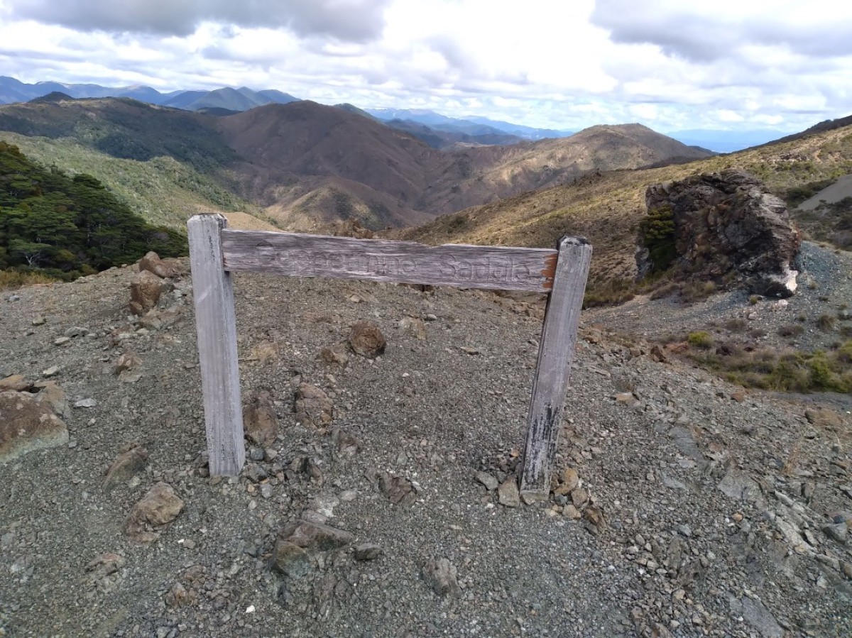
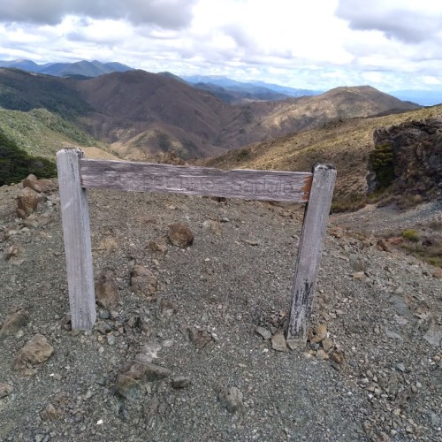
- the crazy geology of Coppermine Saddle (878m)
- early industrial history along New Zealand’s first railway
- Codgers Mountain Bike Park
- a gentle climb through a pretty forest
- evocative information panels
- pre-ride cafes & post-ride pubs
- Maitai Valley’s swimming holes & picnic spots
- proximity to other cycle trails including the Great Taste Trail
From Nelson i-SITE the full loop is 43km, shortened to 38km if you start and finish at the Brook St trailhead (as described here), around 15 minutes’ ride from the centre of town. Allow 4–6 hours, or a full day if you’re the sort of person who likes to linger over their lunch or photograph the odd rock.
Brook Street—Third House
- 11.5 km
- Grade 3 / intermediate
- 1 – 2 hours
The trail begins in the lower reaches of Codgers MTB Park, a fun place to ride with trails to suit most abilities.
This section of the trail, known as the Dun Mountain Walkway, soon joins the old tramway, a narrow gauge, horse-drawn operation that is considered New Zealand’s very first railway. It was used to transport chromium copper from hillside mines – hence the name ‘Coppermine’.
The old tramway line makes for a steady but gentle climb around the flanks of Wooded Peak, aptly named for its cloak of regenerating and mature beech forest. The views back towards Nelson, Tasman Bay and faraway ranges become ever more impressive as you progress.
Third House, the basic shelter at 660m above sea level, is an atmospheric place to rest with the possibility of weka wandering in.
Third House—Coppermine Saddle
- 6 km
- Grade 3 / intermediate
- 30 mins – 1 hour
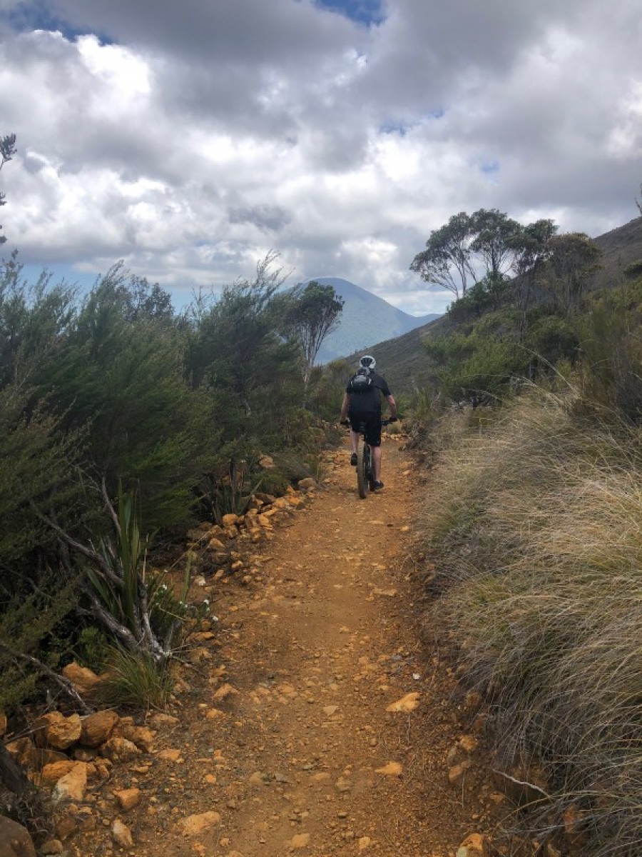
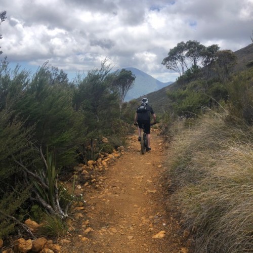
As the trail undulates upwards, the landscape begins its drastic transformation from bushy to bald, before long ushering riders on to an exposed ridge with stunted manuka and other hardy plant life. Welcome to the so-called mineral belt, studded with strikingly coloured rocks.
At Windy Point – which probably will be – the trail continues as singletrack for a couple of kilometres before reaching the trail’s highpoint, Coppermine Saddle (878m). New views of the Maitai Valley and Richmond ranges are revealed around these parts, which combined with its rugged beauty make it a pretty awesome spot to stop for lunch (weather permitting, of course).
Coppermine Saddle—Maitai Dam
- 9.6 km
- Grade 3 – 4 / intermediate to advanced
- 30 mins – 1 hour
Get ready to rumble, because this is a wild ride of fast-forward, kick-ass corners and the odd bit of rock-dodging. Expect watery eyes, white knuckles and an ear-to-ear grin. Recent track work has smoothed out some wrinkles on this wonderful downhill and added in some lovely berms.
Yes, it is rugged, but if you’re a solid intermediate rider, this should be achievable for you. There are a few gnarly surprises and drop-offs, so you can always dismount and walk when the going gets too tough.
Around three quarters of the way down, the gradient eases and the track undulates towards Maitai Dam. Open stretches of flowing track offer a chance to open up the throttle a bit (whoo hoo!), but be aware that this is a dual-use track.
After crossing the Maitai South Branch Bridge, note a left turn on to a walking track signposted to the Maitai Caves. This is a worthwhile side trip if you don’t mind locking your bike to a tree or walking with it for the half an hour each way. The stunning caves are well worth the side-trip.
Maitai Dam—Brook Street
- 11 km
- Grade 3 / intermediate
- 1 – 2 hours
The final section of the Coppermine Trail parallels Nelson’s water pipeline on a cruisy, bush-lined trail on a ledge above the river. After around 4km, at Smiths Ford, the trail joins the quiet Maitai Valley Road.
Tired riders can simply follow the road back to Nelson, while those with gas left in the tank can follow the only marginally harder Maitai Valley Walkway – you can follow this all the way back to the i-SITE, or detour into the backstreets to close the loop back to the Brook Street trailhead. A map or Google will get you there.
Note that from Maitai Valley Motor Camp), super-fit and ambitious riders can head back to Brook Valley via the Groom Creek ‘shortcut’ (taking around 30 minutes) that climbs over Tantragee Saddle (182m) and provides the opportunity to finish with one of Codgers MTB Park’s downhill trails (such as Crazy Horse or Firball).
Source: The New Zealand Cycle Trail