A series of walks up and around Mount Te Aroha offer stunning views and give access to the Kaimai Mamaku Conservation Park.
-
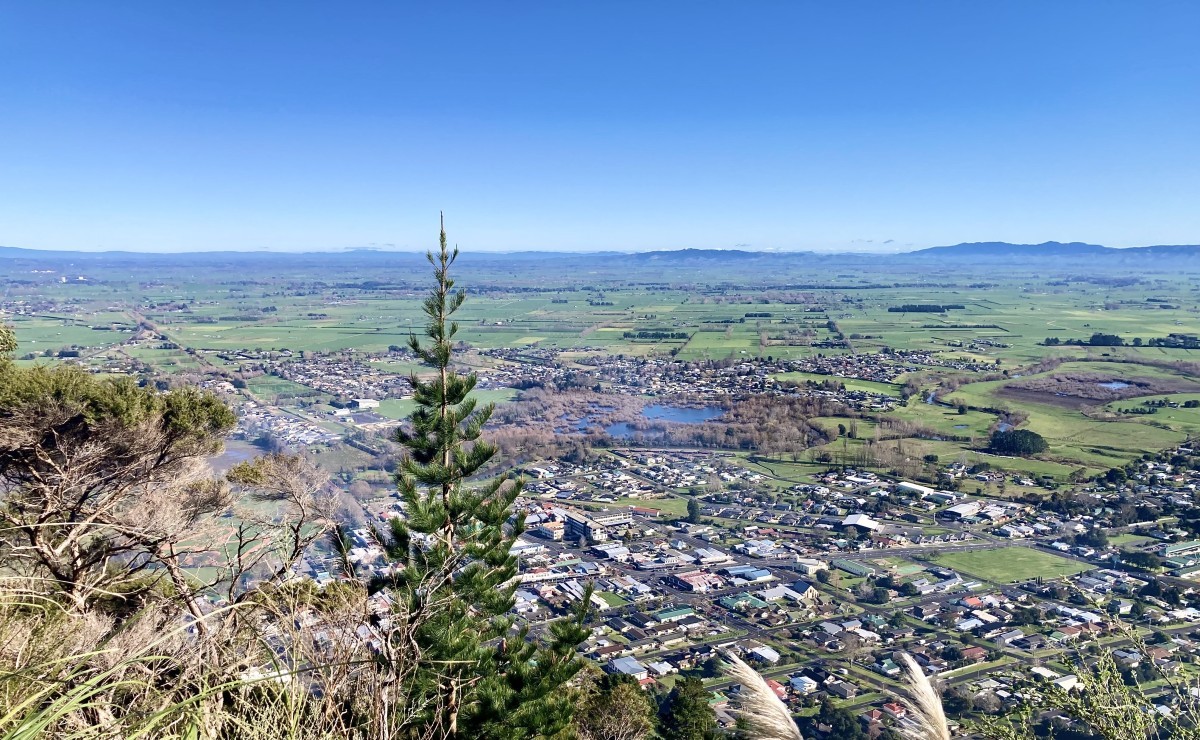 Submitted by Mark Watts1 of 3
 -
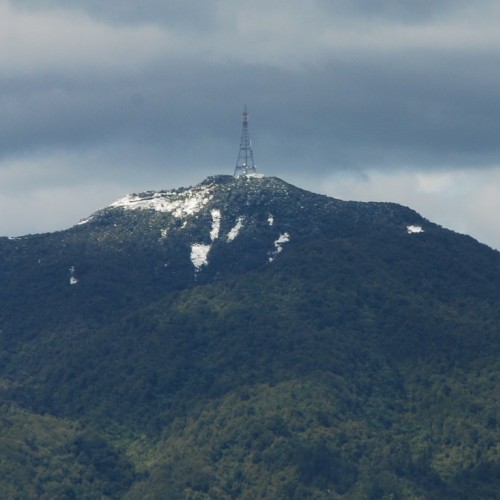
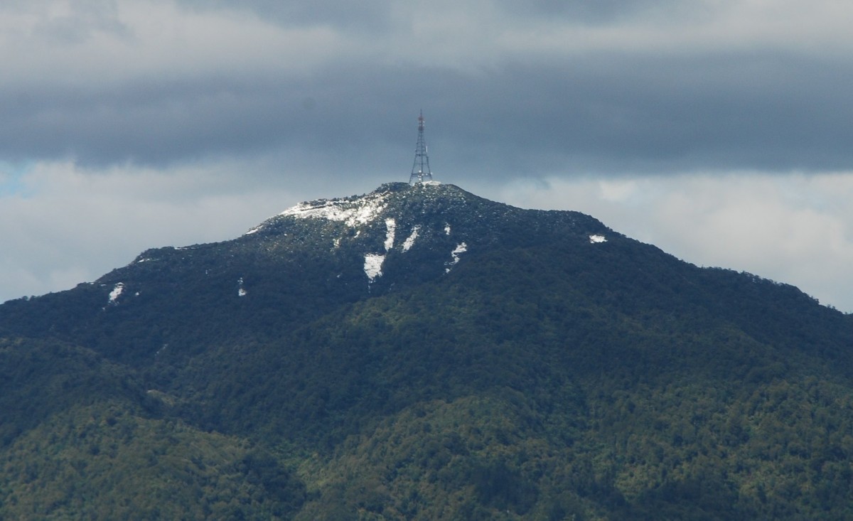 'Snow on Te Aroha'2 of 3
 -
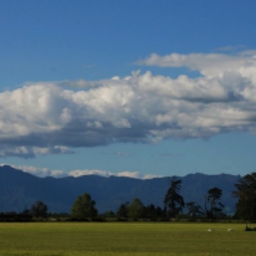
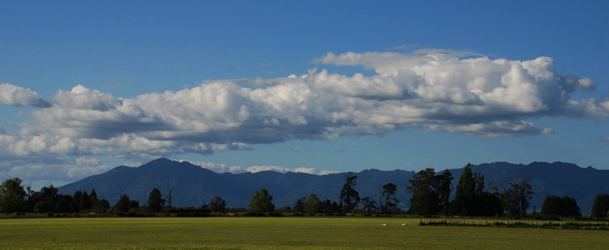 'Clouds over Kaimais'3 of 3
At 952 m, Mount Te Aroha is the highest point on the Kaimai-Mamaku range. A number of tracks are based around and start from the Te Aroha Domain.
Te Aroha Domain Upper and Lower Walks
- Category: Short walk
- Time: 20 min one way each
- Dogs: Permitted on a lead
Beginning at the Mokena Geyser, you choose either the Upper Walk or Lower Walk (which is suitable for pushchairs and wheelchairs). Look out for the beautiful ground-covering parataniwha with red and green leaves along the way. Both walks can be combined to create a loop track.
Tui Domain Track
- Category: Walking track
- Time: 1 hr 30 min one way
- Dogs: Permitted on a lead
Starting at the Mokena Geyser this track takes you through regenerating bush and shallow mountain streams. There is a 5-min detour to the Tutumangao Falls and look out over the town before reaching the junction with the Tui Link track and finally emerging on to Tui Road, near the tailings dam.
Bald Spur Track
- Category: Walking track
- Time: 45 min one way
- Dogs: Permitted on a lead
Starting at the Mokena Geyser, the track zigzags its way through mature pines and pūriri that were planted in the early 1900s. The Whakapipi lookout provides a stunning view of Te Aroha township, the wetlands, river, and beyond. Mt Aroha Mountain Track (see below) continues on through a saddle and then steeply up for another 2 hr to the summit of Mount Te Aroha.
Howarth Memorial Wetland Loop Walk
- Category: Walking track
- Time: 1 hr loop
- Dogs: Permitted on a lead
On the left bank of the Waihou River, a well-formed walk creates a circuit around an established wildlife refuge and wetland area managed by Auckland/Waikato Fish & Game Council. An ideal early morning or evening walk. The bird hide at the end of the boardwalk is the perfect place to spot pied stilt, grey teal, and heron. Access is from Spur St, via a footbridge at the end of Lawrence Ave, or via a boardwalk at Kenwyn Reserve on Kenrick St.
Te Aroha Summit Track
- Category: Tramping track
- Time: 3 hr one way
- Distance: 3.9 km
- No dogs
This track ascends almost 1 km. Follow the track from the Mokena Geyser in the Te Aroha Domain up the well-benched track for 45 minutes to the Whakapipi Lookout which offers views over the Hauraki Plains. The Kaimai-Mamaku Conservation Park begins just above the lookout. The track continues through a small saddle and then steeply up for another two hours to reach the summit. The track becomes steep and the surface is rough.
Mount Te Aroha provides 360-degree views across the Waikato and Bay of Plenty. Ruapehu, Ngāuruhoe, and Taranaki are visible on a clear day. Be prepared for alpine weather conditions at the summit. Return to Te Aroha via the same track (most direct route).
Alternative route via Tui Mine Loop Track
- Time: 3 hr 30 min one way from the summit
- Distance: 8.4 km
- No dogs
This track begins at the Mount Te Aroha Summit and leads back to Te Aroha. Descend from the summit via the stairways and steps on the northeast side. Dog Kennel Flat is reached after 20 minutes at an intersection with Mountain Road. The route then continues north to the Tui saddle before descending steeply to the west down a rocky section and then follows the road for about 15 minutes before taking a marked bush track on the left. Just below here is the Tui Mine and tailings.
The track passes an old concrete explosives magazine, crosses the Mountain Road, and meanders down through lowland forest of püriri and kohekohe leaving the park at the junction with the Tui Domain Track. Follow the Tui Domain Track through regenerating native forest and shallow mountain streams for 1 hour 30 minutes to reach the Mokena Geyser in the Te Aroha Domain. Sidetracks offer alternate exits to Hamilton Street or a detour to the No22 spring. Look out for cyclists as you cross the marked mountain bike track.
Te Aroha summit to Waiorongomai Saddle
- Time: 50 min one way
- Distance: 1.5 km
- No dogs
This track begins at the Mount Te Aroha summit and leads to the Waiorongomai Saddle. A number of longer overnight tramps can be accessed from here. Descend from the summit via the stairways and steps on the northeast side. Dog Kennel Flat is reached after 20 minutes, at an intersection with Mountain Road.
This route then follows the Plutus Claim Track eastward, just below Dog Kennel Flat. After 30 minutes the track meets a junction with the Mangakino Pack Track at the Waiorongomai Saddle and the Crimson Thread Track which heads east. Return the same way or follow an alternative route:
Alternative route from Waiorongomai Saddle to Tui Saddle
Walkers can take a more challenging loop walk back to Te Aroha via the Tui Saddle. Follow the Mangakino Pack Track north for one hour to reach a junction with the Tui Saddle Track, then head west up to the Tui Saddle. From here follow the Tui Link Trackback into town.
Alternative route from Waiorongomai Saddle to Waipapa Track
Follow the Crimson Thread Track east and join the Waipapa Track which leads to Waitawheta Hut (3 hours to hut from Waiorongomai Saddle). From Waiorongomai Saddle to Waiorongomai Head south to reach the Waiorongomai Valley (2 hours to road end).
Alternative route from Waiorongomai Saddle to Waiorongomai
Head south to reach the Waiorongomai Valley (2 hours to road end).
Know before you go
- Mine Tunnels and shafts are dangerous and may be hidden by vegetation.
- Keep to marked official tracks
- Do not enter tunnels unless they are clearly marked for public access.
- Consult a topographic map.
Track condition alert
The upper Mangakino Pack Track south to Te Aroha Mountain and the Mangakino Stream Track to the Old County Road on Karangahake Mountain have both sustained storm damage in January 2018. The track is resettling naturally and continuing to be used safely by trampers, although there are some challenging sections. Take extra care when navigating these tracks.
Source: Department of Conservation

