Distinctive marker posts and, at some locations, interpretation signs link a loop walkway, from West End the town centre, to Point Kean car park. Observe seals and seabirds, explore historic pā and whaling sites and enjoy clifftop views of the sea and mountains. It juts from the rugged east coast of the South Island, with a backdrop of steep mountains, snow-capped in winter.
-
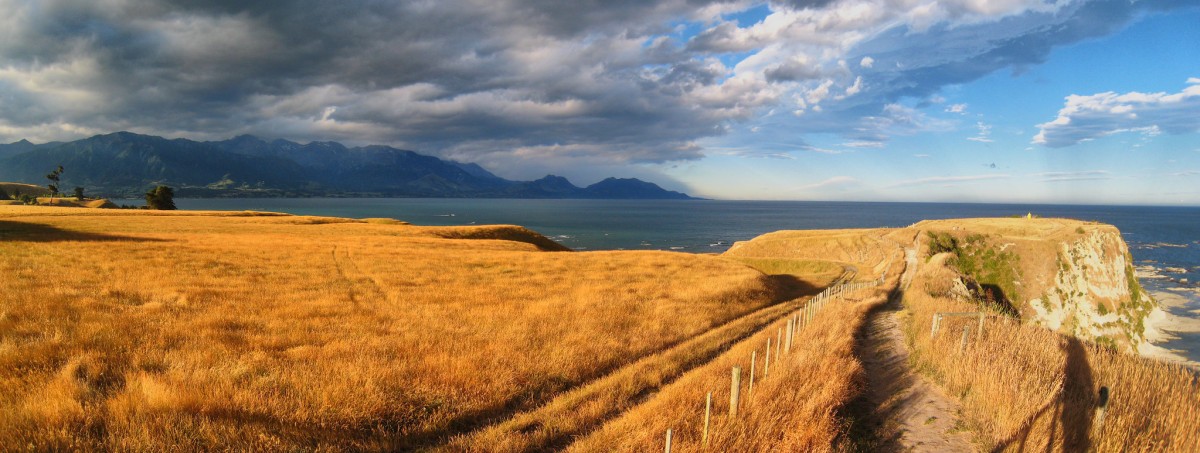
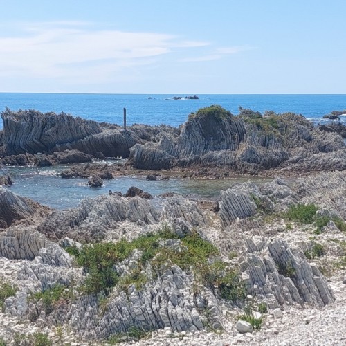
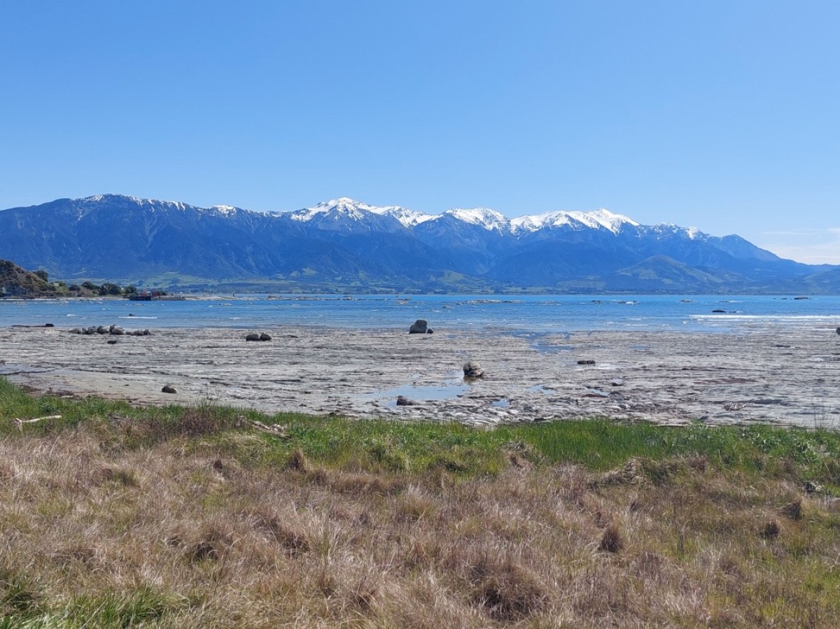 Submitted by Phil Beale1 of 6
 -
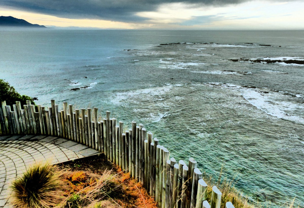
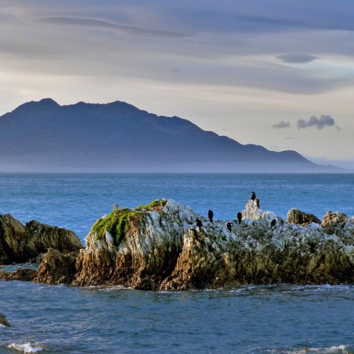
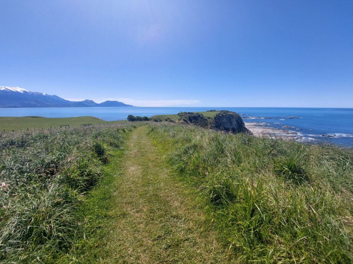 Submitted by Phil Beale2 of 6
 -
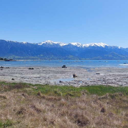
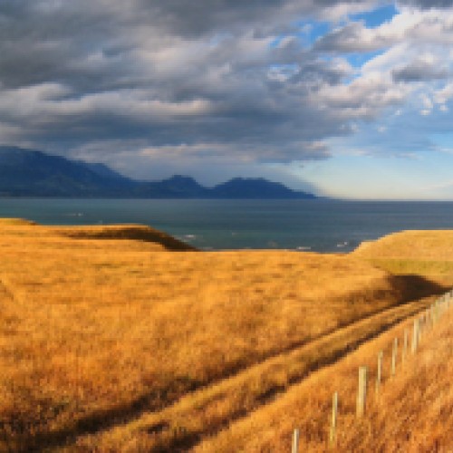
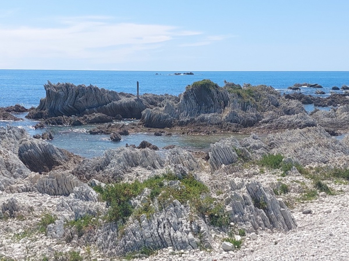 Submitted by Phil Beale3 of 6
 -
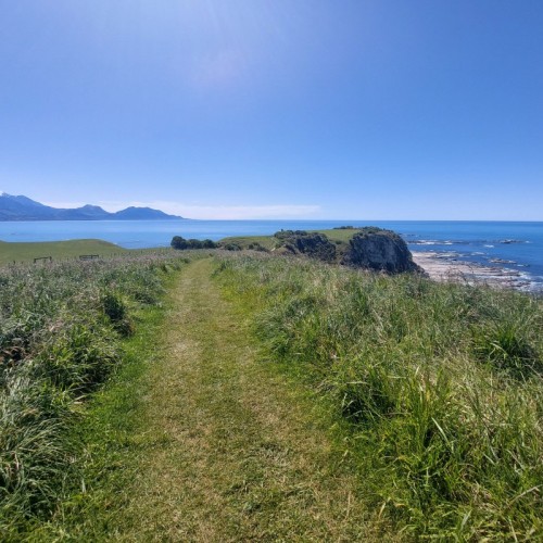
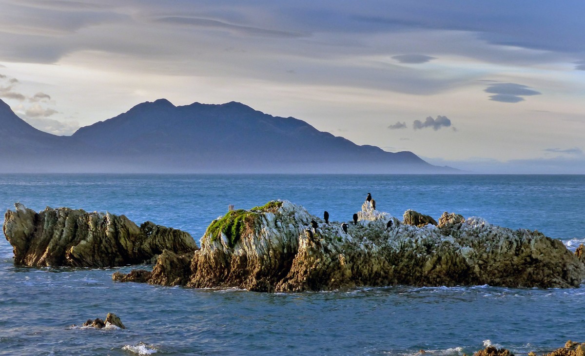 'Kaikoura coastline.NZ'4 of 6
 -
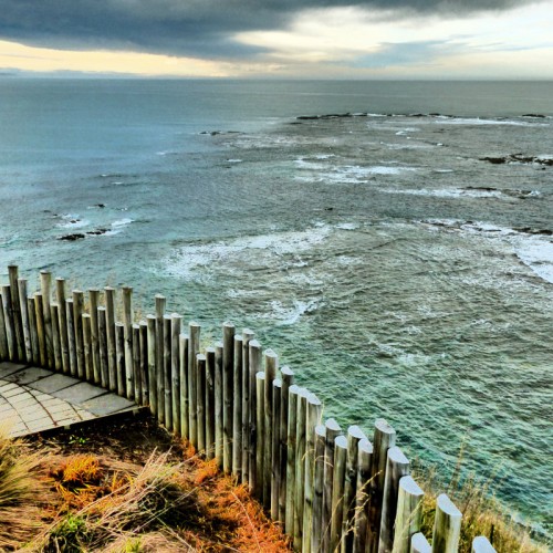
 'Kaikoura Peninsula Walkway'5 of 6
 -
 'Viewing Platform Kaikoura Peninsular'6 of 6
Description
The track crosses the peninsula’s clifftop, with excellent views of the Seaward Kaikōura Range, ocean and coastline, to South Bay. It returns to the township via South Bay and Toms Track.
Distinctive marker posts and, at some locations, interpretation signs link a loop walkway, from West End the town centre, to Point Kean car park.
To fully explore and enjoy the features of the walk, allow at least three hours to complete the whole walkway. The nature of the track means it can be exposed in places. Visitors should stick to the formed track and supervise children and at all times.
Kaikōura town centre to Point Kean car park
- Time: 50 min
- Distance: 4.4 km
From the town centre, follow the footpath and road verge along The Esplanade, Avoca Street and Fyffe Quay to Point Kean. On the way, look out for the interpretation signs on The Esplanade opposite Brighton and Margate Streets, telling stories of 'Life on the edge', a community living by the sea — the land, the sea and the people. At Avoca Street, the sign takes you back to 1909, when the new wharf was built. Near Fyffe House, a sign details the early European settlement in Kaikōura and, at nearby Armers Beach, the story tells of the importance this site holds for the local community, both past and present, for the shelter it provides.
Near Point Kean car park, there are signs warning that seals are likely to be present in the surrounding area. Most of the seals in the car park are males. They may appear to be harmless – however they are capable of becoming aggressive if disturbed and can inflict a nasty, infectious bite.
The seals on the rocky platforms out from the car park are females and their pups. For your safety and to avoid disturbing the seals, remain 10 m from any seal in the vicinity of the car park. Along the rest of the Kaikōura Coast, 20 m is the recommended distance to keep away from a seal.
There are toilets at the car park.
Point Kean car park to Point Kean viewpoint
- Time: 5 min
- Distance: 200 m
Walk up the hill from the car park to a lookout platform. This platform, designed in the shape of a waka, affords an excellent view of both the sea and the mountains. Interpretation panels provide stories of the land, the sea and the people who lived here.
From the car park when the tide is low, you are able to explore the open tidal platforms. You may see wading birds, such as oystercatchers and reef herons, feeding on the platforms. Shags are common and blue penguins may be seen bobbing just offshore.
Just off the tidal platforms is an excellent diving and snorkelling area for those who want a closer look at the marine life.
Point Kean viewpoint to Whalers Bay viewpoint
- Time: 25 min
- Distance: 1.5 km
Beyond the lookout platform, follow the track along the clifftop for superb views of rugged cliff formations, tidal platforms and the Seaward Kaikōura Range.
An interpretation panel on this section of the walkway explains that, hundreds of years ago, the peninsula was forested with many species of native New Zealand trees and plants. Most of this vegetation was removed during successive waves of human development, leaving small, remnant outcrops of hardy shrubs and plants clinging to the steep cliff faces.
Whalers Bay side-trip
This track down a stariway follows a former whalers’ route down the cliff to the shoreline. A prominent feature in this area is known as 'the Sugarloaf'. Don't climb this landmark, to prevent further erosion.
View seabirds, seals, walkers, divers, crayfish floats and fishing boats. Out to sea, you may see scores of seabirds feeding frantically on small fish herded to the surface by bigger fish or dolphins.
Take care to avoid disturbing any wildlife along the shoreline as there are large colonies of birds in the area. These are particularly vulnerable to disturbance during the breeding season over summer.
Return back up via the same cliff track, as tides or seals along the shoreline may prevent you from returning to the car park.
Interpretation on the clifftop overlooking 'the Sugarloaf' describes the point below as 'Bird City' – the largest red-billed gull colony in the South Island. From here, whalers kept a vigil over the sea, looking out for their quarry. Around the corner in Whalers Bay was the launching point for the whalers’ boats.
Whalers Bay viewpoint to South Bay viewpoint
- Time: 20 min
- Distance: 1.1 km
On the sea cliffs near this section of the walkway, is a new colony of Hutton’s shearwater behind a large predator-proof fence. In summer you may see large rafts of these birds sitting on the water. At nightfall, after feeding at sea all day, they return to their breeding colonies high up in the Seaward Kaikōura Ranges. An interpretation panel explains the work being undertaken to establish a colony on the Kaikōura Peninsula.
South Bay viewpoint to South Bay car park
- Time: 15 min
- Distance: 600 m
From the South Bay viewpoint, the walkway descends to a fully accessible path that leads to an information shelter and toilets at South Bay. Before descending to South Bay, linger to view the tidal platforms and the view south. The interpretation panel here has a landscape profile identifying the mountain peaks and Goose Bay.
South Bay to Kaikōura town centre via Scarborough Street
- Time: 1 hr 5 min
- Distance: 3.9 km
From the South Bay shelter, return to Kaikōura town centre by following the marker posts along the coast towards the marina. Follow the marker posts to South Bay Parade and cross to South Bay Track, walk up the hill, cross Scarborough Street and walk down Toms Track to return to The Esplanade.
Other options/short walks
South Bay car park to Limestone Bay
- Time: 5 min
- Distance: 250 m
At South Bay, a fully accessible path from the car park takes you to Limestone Bay. The elevated walkway above the tidal platform gives wonderful coastal views and allows you to smell the ocean and watch the birds.
Limestone Bay to South Bay viewpoint
- Time: 10 min
- Distance: 350 m
This climb up to a viewpoint on the clifftop rewards you with superb views of tidal platforms, cliff formations and Haumuri Bluffs to the south.
Getting there
The walkway starts from Kaikōura township. Kaikōura lies almost midway between Picton (154 km) and Christchurch (183 km) off SH1 on the east coast of the South Island. Regular bus and train services pass through the town.
There is no scheduled public transport from Kaikōura to the walkway but it is possible to arrange commercial transport.
Know before you go
- Keep children with you at all times, especially along the clifftop and at the water’s edge. Keep to the formed track of the walkway. It is dangerous to descend the cliffs on unformed tracks.
- Do not trample plants as the cliffs are being revegetated. To descend to the shoreline, use the formed track down to Whalers Bay and return via this same track.
- The peninsula is very exposed to coastal winds. Weather conditions can change quickly, especially when a southerly storm arrives: be prepared with warm and windproof clothing.
- High tide may restrict access along the shoreline.
- Many animals and birds make the peninsula their home. Observe wildlife from a distance. If birds start flying at you, this is their way of telling you that you are too close to them.
- Report any injured or stressed wildlife to our hotline 0800 DOC HOT (0800 362 468).
- No fires are allowed on the walkway, on the shoreline, or in the car parks at Point Kean and South Bay.
- There are no toilets on the clifftop. Toilets are located at Armers Beach on the way to Point Kean car park and in South Bay.
- Sections of the walkway cross private land. Respect farm property and stock and do not take vehicles, mountain bikes, firearms, or dogs on the walkway.
- There are no rubbish facilities along the clifftop. Use the rubbish and recycling facilities at the car parks.
- Mountain biking is not permitted on the walkway.
- Dogs and other pets are a threat to wildlife. They are not allowed on the tidal platforms or on the walkway except on these sections: town centre to Point Kean car park but not in the car park and within the confines of South Bay Recreation Reserve and along South Bay Parade to the start of South Bay Track
Source: Department of Conservation

