-
 Submitted by Lisa Pitcher1 of 3
 -
 Submitted by Lisa Pitcher2 of 3
 -
 3 of 3
Notice of Lake Dunstan Rabbit Control Operation
Rabbit control operations will be undertaken within the Lake Dunstan area from 19 May to 30 June 2025. The work will take one day to complete. Operations are weather-dependent and will not take place on weekends or public holidays.
Burrow fumigation using magnesium phosphide will occur at the following site during daylight hours:
- Lake Dunstan shoreline – from sewage oxidation ponds to Bannockburn Bridge
As a precaution, pets must be kept under control and children closely supervised in the operational area throughout the control period.
Cyclists and walkers experiencing the Lake Dunstan Trail will marvel at the man-made landscapes, the rich Maori and early pioneer history, and amble through the vineyards of Bannockburn.
The region’s rich modern, pioneering and Maori historical stories are integrated along the way, some of which are brought to life in the Clyde and Cromwell Historical Precinct.
The Lake Dunstan Trail extends and complements the well-established Great Rides in Central Otago and the Southern Lakes, and provides a key link with the Otago Central Rail Trail and the Roxburgh Gorge Trail, both of which are part of Nga Haerenga - New Zealand Cycle Trails.
Lake Dunstan Trail Sections:
- Smiths Way to Cromwell Heritage Precinct - 16km - Now Open
- Cromwell Heritage Precinct to Bannockburn Bridge - 6 km - Now Open
- Bannockburn Bridge to Cornish Point - 7.3km - Now Open
- Cornish Point to Clyde - 25 km - Under Construction - Now Open
Smiths Way to Cromwell Heritage Precinct - 16km - Now Open
Already popular, this section of trail is a popular day ride or walk to / from Cromwell. It wends its way alongside Lake Dunstan from Smiths Way via Pisa Moorings to Cromwell.
There are many places to rest a while beside the lake, with swimming, boating and other water sports all popular along most of its distance. At Cromwell Heritage Precinct be sure to park up and explore the boutique galleries, retail stores, restaurants and cafe's.
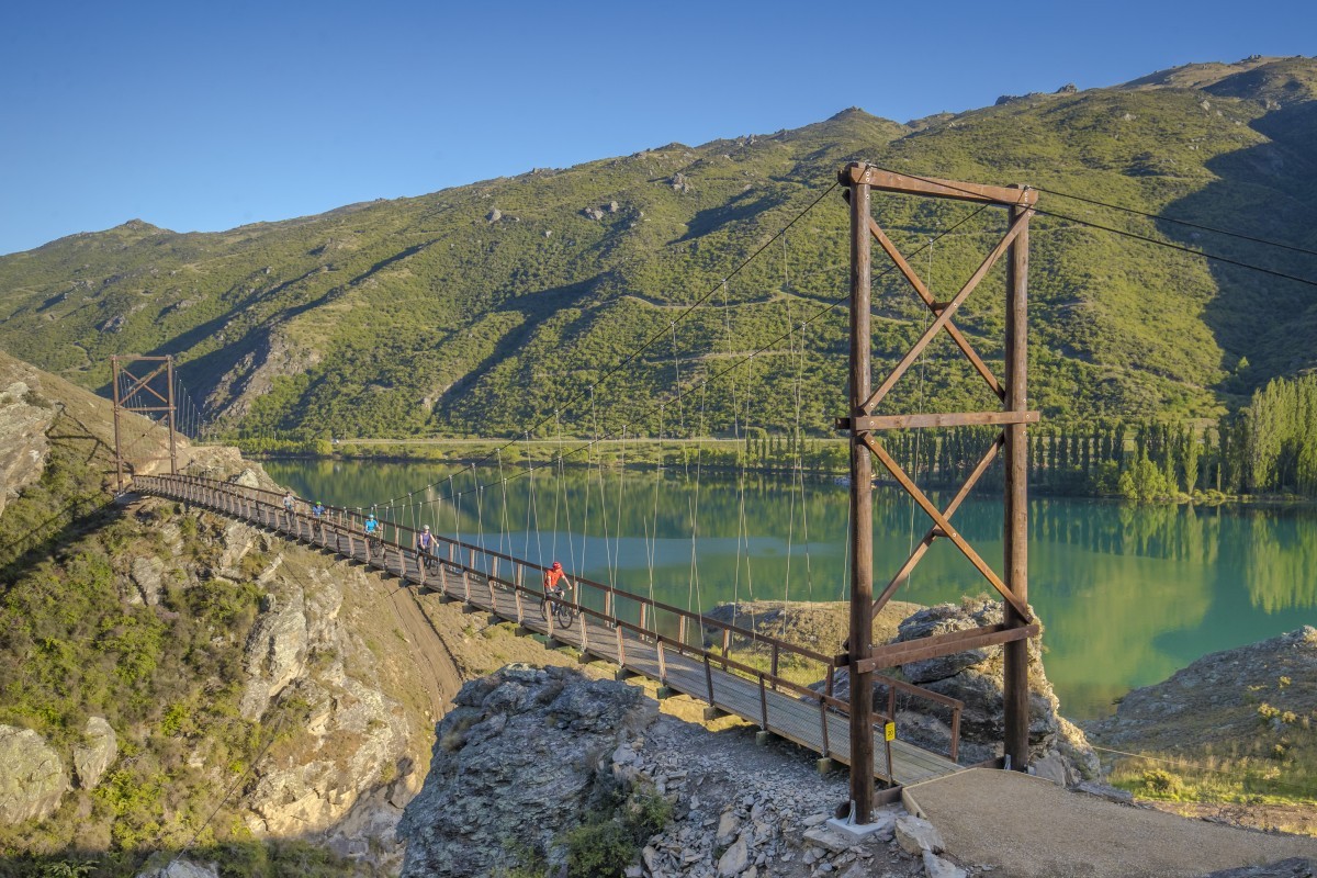
Cromwell Heritage Precinct to Bannockburn Bridge - 6 km - Now Open
Following the Kawarau arm of Lake Dunstan to the Bannockburn bridge, you will have amazing vistas across the lake to Bannockburn vineyards and the next section of trail which loops back round on the opposite side. Along the way there are sections where the land has been reshaped in the search for gold and then again when the lake was formed.
It is possible to loop back to Cromwell by a trail alongside Bannockburn Road - making for a wonderful short and family friendly day ride.
Bannockburn Bridge to Cornish Point - 7.3km - Now Open
After crossing the Bannockburn Bridge the trail loops back and around the Bannockburn Inlet which is a popular picnic area with a designated swimming area. As it continues toward Cornish Point it passes by vineyards and olive groves - with views back across to Cromwell and the Heritage Precinct.
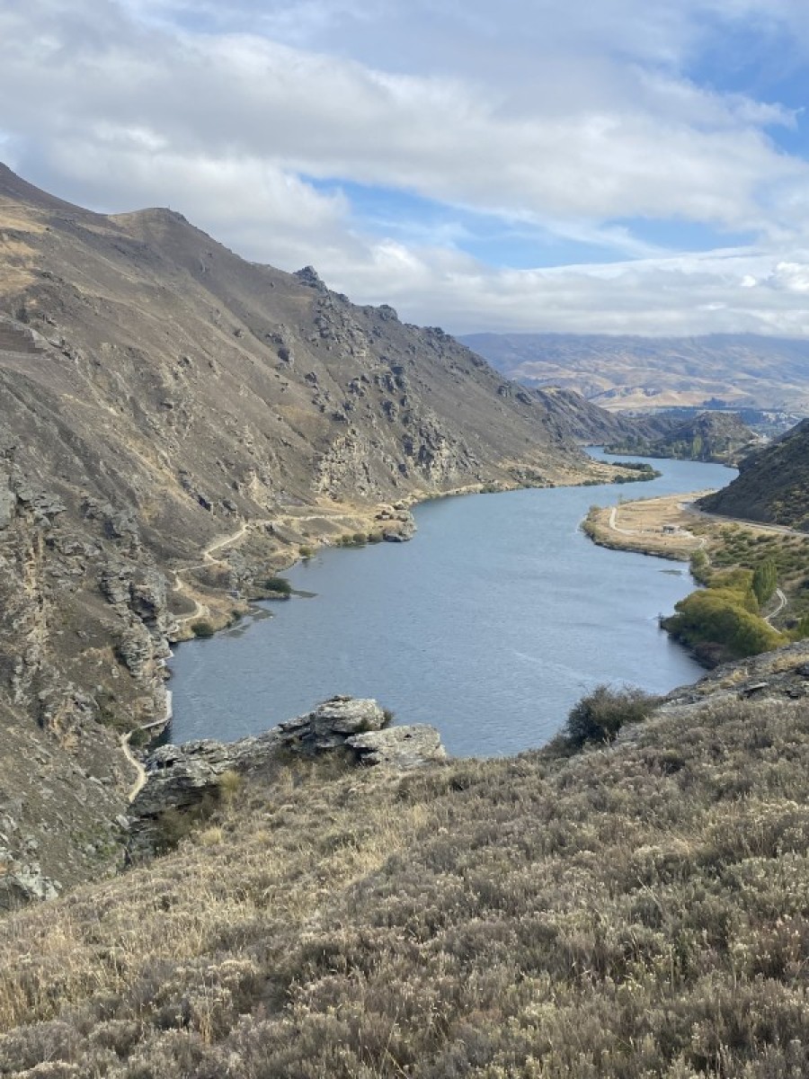
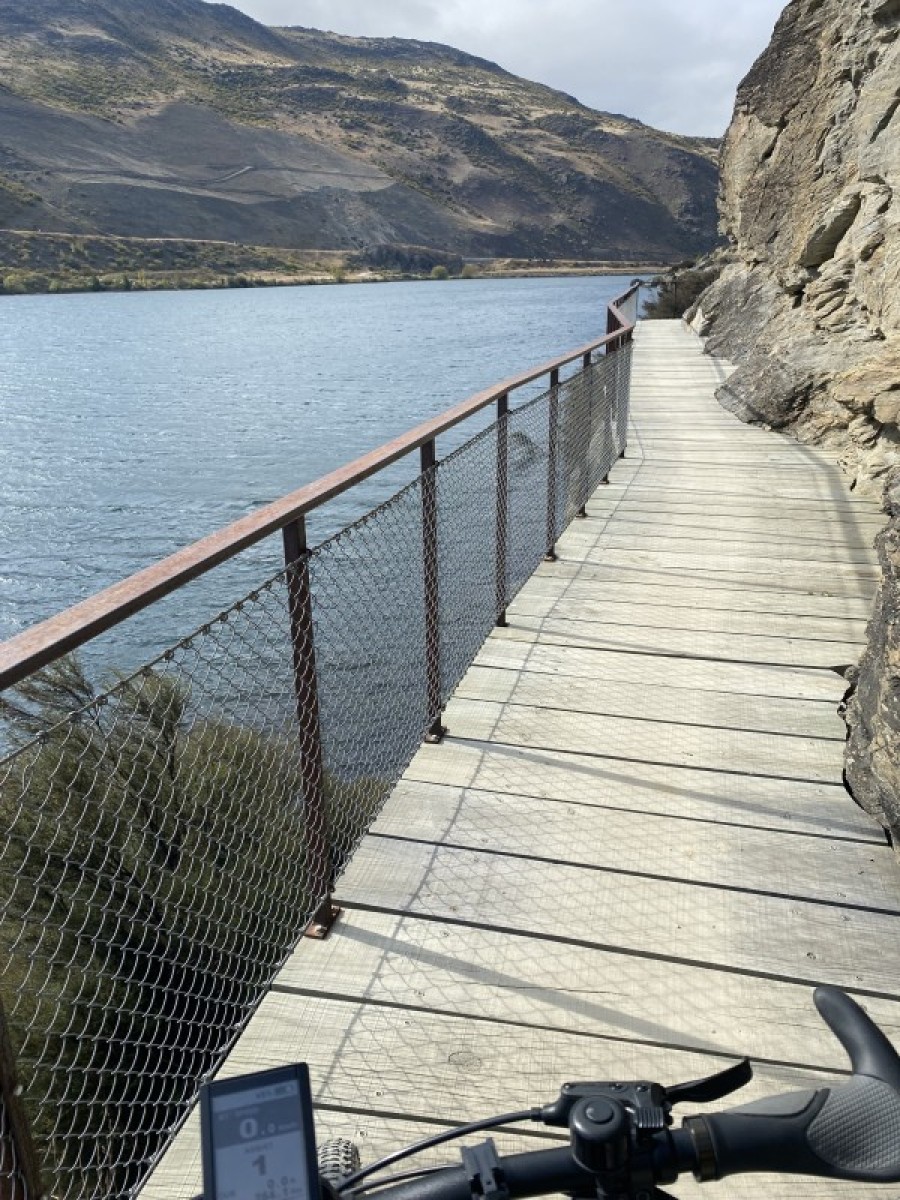
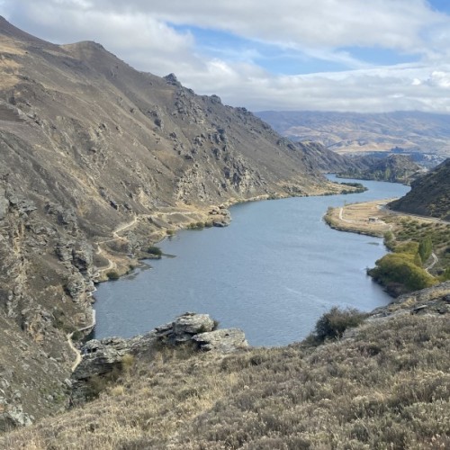
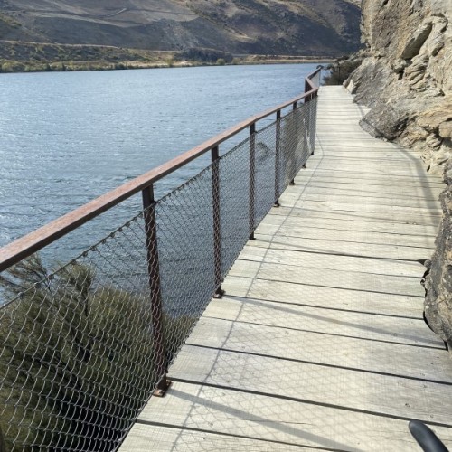
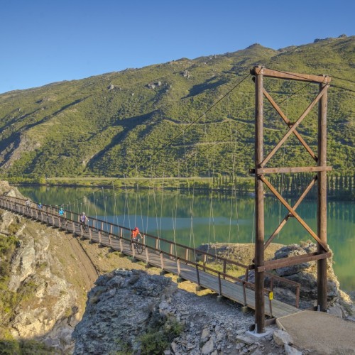
Cornish Point to Clyde - 25 km - Now Open
This section of trail takes you into the Cromwell Gorge. You will be amazed at the skills of trail builders with sections built out around sheer rock faces.
You will cycle at the base of the stonework faces of the Cairnmuir slide, a unique feature high on the slopes above the lake. It was designed to protect the river from a major land slide, which could overwhelm the Clutha Dam, a short distance downstream. Also look out for the drainage tunnels dotted along the length of the gorge. There are 13 tunnels (total 18.5km of tunnels) drilled into the hillsides of the gorge in the mid 1990’s. These tunnels are also used to mitigate against landslips into the Clutha River.
A dominant feature at the Clyde end of the trail is New Zealand’s third largest hydro-dam, the Clyde Dam. This was one of the ‘’Think Big” projects driven by the Muldoon led Government to diversify the economy and drive growth. Started construction 1977. The first power was generated in 1992
Source: Central Otago NZ