-
 'Mangahao'1 of 1
Back Track to Burttons Track - 7km / 2-3hr
Cross Black Bridge and follow Back Track, a former road which was closed in the 1960s. It is a steady climb up, mainly through native bush but with some open farmland allowing good views over the Manawatu and some pine forest near the top. Small streams are crossed and altitude rise is 200m before reaching the end of Scotts Road. A toilet has been installed in October 2018 at the Arapuke Scotts Road Carpark. The final 2km along Scotts Rd leads to the entry to Gordon Kear Forest. From Scotts Road, a stile crosses the fence and an information sign is located just before the bridge over the Kahuterawa Stream.
The walk to the start of the Burttons Track commences following the metalled forestry road alongside the Kahuterawa Stream. Keep right at the first "Y" in the road and after approximately 40min from the start take the clearly signposted "Toko Corner Rd" to the right.
The Palmerston North City Council (PNCC) has established an approved campsite for TA hikers in Gordon Kear Forest at a 28km walk from Palmerston North and 32 km before Makahika Outdoor Centre.) It is in a clearing at the junction of Toko Corner Road and Centre Road. PNCC have built a shelter, (whare) called Motorimu. There will be a picnic table and a rubbish bin. There is a permanent freshwater stream at the site. The council will put a Protaloo there from mid November 2018 to end of February 2019 approximately. For forestry safety reasons this is the only PNCC approved site for TA hikers to camp in Gordon Kear Forest.
After a 5 minute walk along Toko Corner Rd the trail enters a recently felled pine forest. Continue through the forest to a stile next to a locked gate, approximately 1hr walk from the locked gate just past the Loop Road sign post. Carry on, passing a second gate as you leave the plantation forest behind and enter regrowth native bush. The track climbs uphill to a stile and a DOC sign at the start of Burttons Track.
Burttons Track - 15.5km / 6hr (7hr northbound)
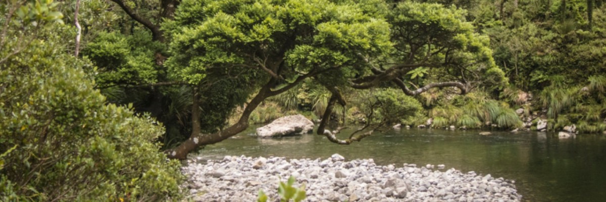
Descends through native forest to Tokomaru Valley. The track crosses the No 1 stream, sidles downstream a short distance and then begins to follow up the Tokomaru River. Remains of an old campsite with rusting iron are passed. After descending to the river and crossing No 2 creek, the track continues to follow the Tokomaru River upstream, clearly marked with large orange triangles.
The track continues on the true right of the Tokomaru River for 15-20min. The trail here is on private land. Firearms are not permitted and dogs must remain on a leash.
You soon re-enter the forest park and the start of the original Burtton’s Track. Five minutes further on the former Burtton’s Whare site is reached. Considered as midway, it is an ideal site for a lunch break and to absorb something of the history, well described in Ian Argyles book Burtton’s Track.The site of the former swingbridge that crossed to his farm on the western side of the river, that collapsed leading to the death of Jim Burtton in 1941 can be seen.
You may see a cottage on the other side of the stream however this is a private residence, please stick to the marked route (do not cross the river and continue south. The trail here goes over private land and we do not want to upset the owner who has given us permission to go over their property.
From here the track is the historical trail built by Jim Burtton almost 100yrs ago. Mostly benched and of good width through regrowth bush, it follows up the Tokomaru River passing some attractive open clearings. Remains of old bridges and other structures can be seen along the way.
After another 1½hr, a stile is crossed as the track passes out of Tararua Forest Park.
The final hour of walk is 3.2km is along the former Tokomaru Valley Rd (now closed to unauthorized traffic but is sometimes used by registered 4WD vehicles) to the junction with Mangahao Rd.
Shelter
About 1km back on Tokomaru Valley Road from the junction of Mangahao Road a new shelter called 'Tokomaru Shelter" is now open to TA walkers. There is a table and five chairs and a visitors book there now. There is also an outside toilet near the site.
Potential hazards:
- Vehicles on road or track Stay alert for logging traffic in Gordon Kear Forest
- Poisons & traps
- Forestry operations
- River crossings - Never cross flooded rivers
- Small stream crossings
- Track exposed to sun, wind or cold
- Weather extremes
Burrtons Track:
Please note: This trail crosses private land - Open daylight hours ONLY. NO Horses, guns, vehicles, fires in the forest.
Dogs MUST be ON leash.
How to get here
Northern Start: Old West Rd (SH57), Palmerston North
Southern End: Junction of Gladstone and Poads Rds, Levin