Various Walks - loop & one way options. 2 or 5 hours.
Explore pack tracks and tramlines from gold mining days - the shorter option is suitable for children and follows New Zealand’s oldest known railway (1882-83) with the original rail still in place.
-
 Submitted by Janet Burnett1 of 3
 -
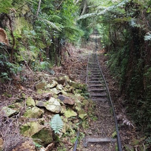
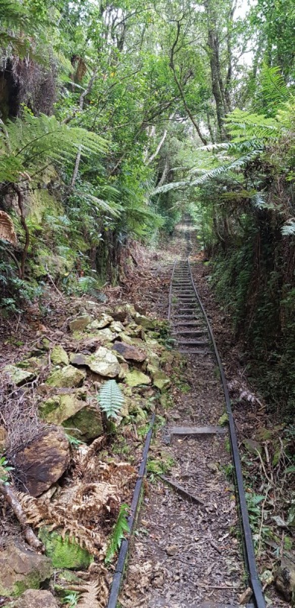 Submitted by Janet Burnett2 of 3
 -
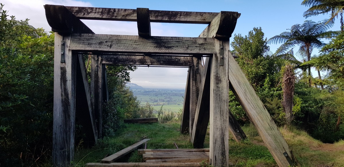
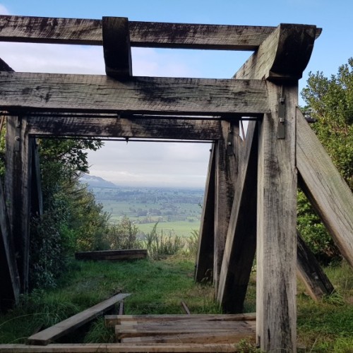
 3 of 3

Low-Level Loop
- Time: 2 hr loop
- Distance: 5.5 km
An interesting walk for children, this well-graded track takes in several significant sites around the lower Waiorongomai goldfields. From the car park go up the stairs to the left of the concrete ruins and then follow the signposted Low-Level Loop to the right. The track winds up the valley through regenerating bush across a few small streams and passes a small tunnel and a pipeline.
After about an hour the loop turns back south at the signposted junction and joins the Piako County Tramway at the base of Butlers Incline, with the rail still in place giving a sense of how the tramway worked. The walk then descends along the tramway to the top of the Fern Spur Incline giving views to the south. It is a short walk down the hill from here to the car park.
Alternative route from Butlers Incline to Premier Creek
Beginning at the bottom of Butlers Incline, this track leads up the valley and connects with the Mangakino Pack Track and the Waipapa Track for longer overnight walks along the Kaimai Heritage Trail. From the Low Level Loop turn up the steep Butler’s Incline. Follow the Piako County Tramway, passing a junction with the High Level Track after 40 metres. This section is a level grade with rail lines along most of the length.
The track then crosses Diamond Creek before reaching an intersection, and then follows the historic Low Level Track up the May Queen Incline. The track continues along the tramway and passes another junction and a short but dark tunnel. The tramway finishes at Premier Creek. Add 1 hour 30 minutes to reach Premier Creek. Return the same way or take the Mangakino Pack Track north to the Waiorongomai Saddle.
Alternative route via New Era Branch Track
This is an alternative way to approach the head of the valley, avoiding Butlers Incline. Take the New Era Branch Track to the right at the signposted junction with the Low Level Loop, just before reaching Butlers Incline. There are two stream crossings which can be difficult after rain. This track meets up with the Piako County Tramway just below the May Queen Incline. Add 1 hour to reach the May Queen Incline. Return the same way or via Butlers Incline.
High Level Pack Track
- Time: 2 hr 30 min one way
- Distance: 4.3 km
This track climbs steadily up the valley and leads towards the Waiorongomai Saddle. Take the steps behind the concrete ruins and follow the signs for the High Level Track. Continue straight on at the junctions with the Low Level Loop and the Buck Rock Track, reached after about 30 minutes. The path crosses a number of streams before ascending to a bridge across Butlers Incline.
The following junction gives access to a number of other tracks. The High Level Track branches to the left and continues upwards, passing several mine portals and waterfalls. It levels out just before the old mining camp known as Quartzville, then descends to the historic Low Level Track, just above the May Queen Incline. Return the same way or return via the Low Level Track heading south. Overnight walks are accessible by continuing north to the Waiorongomai Saddle.
Pylon Peak Summit Track and Loop
- Time:
- 2 hours to summit
- 6 - 7 hour loop
- Distance:
- 4.4 km to the summit
- 13.7 km return
The Pylon Peak Summit Track and loop offers views of Mt Te Aroha and Hauraki Plains and key heritage sites. It's long and steep sections require a good level of fitness, especially towards the ridge and summit. The track and loop are accessed from the Low-Level Track, which starts at the carpark at the end of Waiorongomai Valley Road. Walk 5 minutes to sign junction about 130 m along the Low-Level Track to access it. A stream crosses the beginning of it.
Take the forested track, which follows an old water race, winding up the hill to the ridge and summit. Along the way, look out for the remains of the old power pylons, which took power from a hydro dam near Lake Karapiro to the Victoria Battery near Waikino. Enjoy the views along the Kaimai ridge of Mt Te Aroha and Hauraki Plains from the North South Track Junction. At this point continue on the North South Track to the Waipapa Track, to loop back to the carpark via Waiorongomai Valley.
Getting there
Waiorongomai walks start from the car park at the end of Waiorongomai Loop Road near Te Aroha.
History and culture
A prospector, Hone Werahiko found gold in the Waiorongomai Valley in 1881. The goldmines were never very successful - expensive engineering projects failed due to low yields from the unexpectedly hard rock of the enormous gold bearing reef. One of these projects was the Piako County Tramway which is a feature of many of the walks.
Know before you go
- Mine tunnels and shafts are very dangerous and may be hidden by vegetation:
- Keep to official marked tracks
- Do not enter tunnels unless they are clearly marked for public access
- Consult a topographic map.
- No mountain biking is permitted.
Before you go into the outdoors, tell someone your plans and leave a date to raise the alarm if you haven't returned. To do this, use the New Zealand Outdoors Intentions process (external site) on the AdventureSmart website. It is endorsed by New Zealand's search and rescue agencies and provides three simple options to tell someone you trust the details about your trip.
Source: Department of Conservation