Walk to the Hawke's Bay highest waterfall or choose another walk in an area where native forest and birds are protected from pests and predators - shorter options are suitable for children.
-
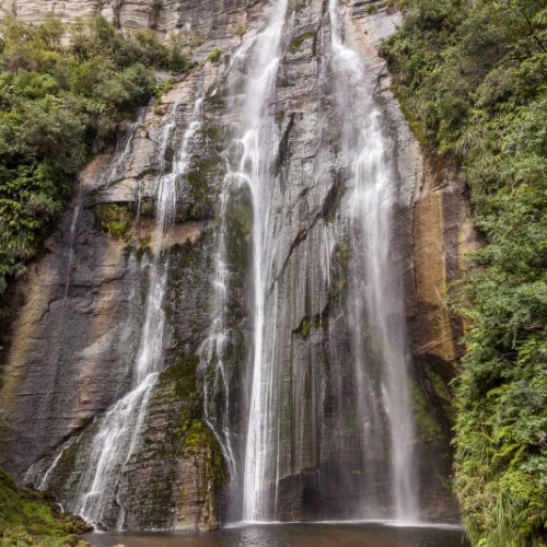
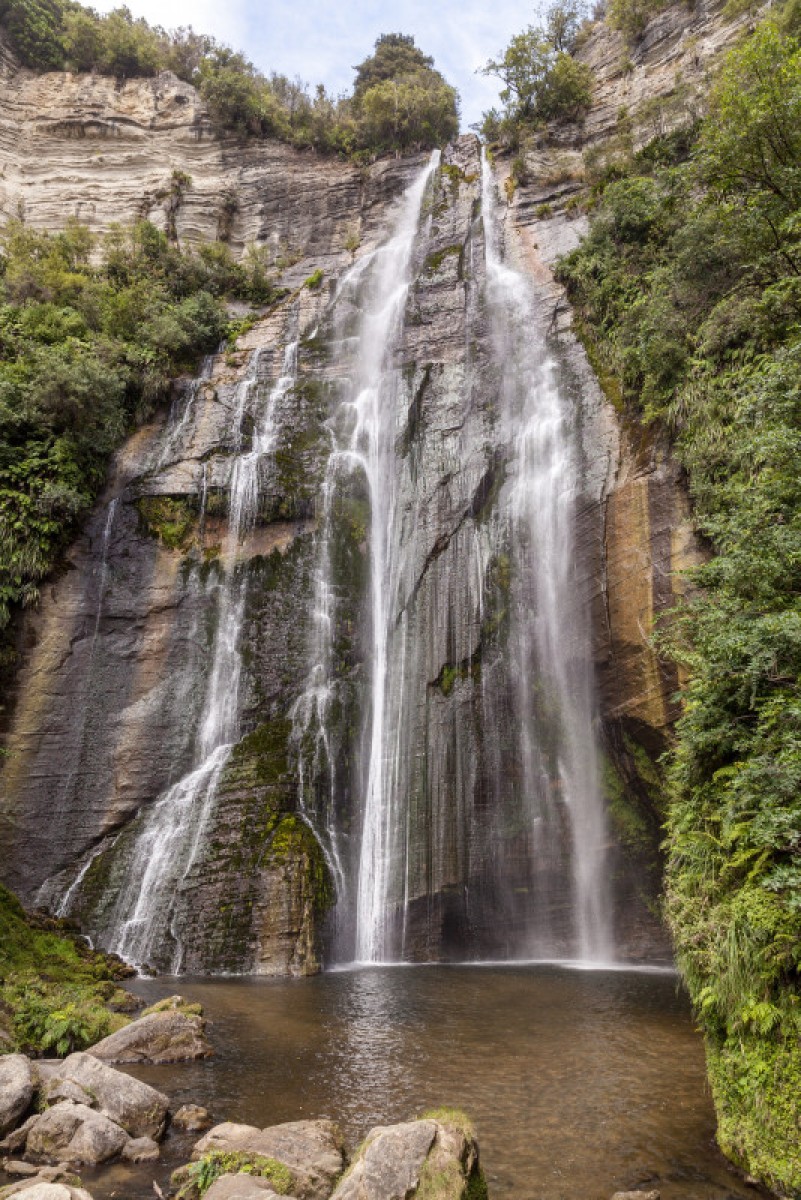 'Shine Falls'1 of 1
Source: Russell Street / Creative Commons)
Tumanako Loop Track
- Time: 1 hr loop
- Distance: 1.4 km loop
The Tūmanako Loop Track is great for children. It offers a variety of forest types, birdlife and viewpoints with evidence of pioneer logging history and subsequent natural forest recovery of kāmahi, tawa, tawhairaunui/red beech and tawhairauriki/black beech forests.
A variety of birds including pītoitoi/North Island robin, pōpokotea/whitehead, tītitipounamu/rifleman, kōkako and korimako/bellbird live here. Sometimes you can spot an inquisitive kākā and, if you’re lucky, you may hear a kōkako. Kārearea/New Zealand falcon are frequently seen from vantage points along the track.
Keep your eyes open for wētā motels along the track.
Rare plants such as neinei, yellow-flowered mistletoe and ngutu kākā/kākābeak may be seen.
Heays Access Road to Shine Falls Track
- Time: 1 hr 30 min return
- Distance: 4.4 km return
This popular track, suitable for children, wanders through farmland, past castle-like limestone formations and into mixed lowland forest before emerging at the base of the stunning Shine Falls – the highest waterfall in Hawke’s Bay at 58 m.
Kākābeak grow on the cliffs with the surrounding forest made up of kānuka, kawakawa, kōwhai and tītoki.
Pack a picnic lunch and look for tuna/eels living in the stream at the base of the falls.
Kamahi Loop Track
- Time: 2 hr
- Distance: 4.5 km
The Kamahi Loop Track passes through mature podocarp forest for the first 400 metres. An ancient mataī grows near the junction of the loop track. Along the bluff tops, aerial displays from kererū, tūī and korimako/bellbird are often seen.
This is a key site for visitors to observe vegetation recovery and the diverse vegetation of the reserve. The ‘ghost forest’, a monoculture of kāmahi trees, sprang up after fires swept through the area around 100 years ago. The kāmahi is one of the first trees to regenerate when land has been cleared. It provides a stable environment that allows other species, like podocarp and broadleaf, to mature. Once these species reach the canopy they will out-compete the kāmahi for light and the forest will revert to its original state.
Bell Rock Loop Track
- Time: 3 hr loop
- Distance: 5.3 km loop
From the Pohokura Road entrance, the Bell Rock Loop Track climbs through a forest of gnarled broadleaf, horopito/pepperwood, fuchsia and mataī. The track emerges onto the range though a dense stand of mountain holly providing spectacular midsummer floral displays. Bell Rock is 40 minutes further along the left track.
The right track returns to Pohokura Road via a 4WD track and provides panoramic views, including the Mohaka valley to Te Kooti’s Lookout and further afield to Whirinaki Te Puaa-Tāne Conservation Park. Return via Pohokura Road.
Kamahi Loop Track to Shine Falls and Heays Access Road
- Time: 5 hr one way
- Distance: 8.3 km one way
Starting at the Pohokura Road car park and taking in part of the Tūmanako and Kamahi loops, visitors experience a cross-section of the reserve’s features – including an ancient mataī about 800 years old and birds such as tītitipounamu/rifleman and the reintroduced pītoitoi/North Island robin. Middle Track, between the midpoint
of Kamahi Loop and Shine Falls, may be steep and rough in some sections. From above Shine Falls, the track descends steeply through stands of rewarewa, crossing Boundary Stream to reach the bottom of the spectacular Shine Falls before continuing to Heays Access Road.
Getting there
Boundary Stream Mainland Island is located approximately one hour's drive north of Napier. Follow State Highway 2 to Tutira, turn left at Tutira onto Matahorua Road then left onto Pohokura Road.
Nature and conservation
You can see native birds throughout Boundary Stream. The haunting song of kokako can often be heard at the Tumanako carpark, and you may even lucky to catch a glimpse of this special New Zealand bird. Our native freshwater eels can sometimes be seen in the Shine's Falls pool.
Source: Department of Conservation

