-
 'Kapiti island'1 of 1
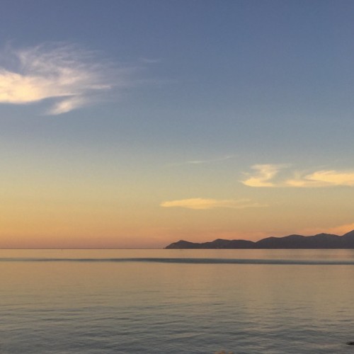
An easy day’s walking after the rigors of Tararua tramping! The trail is virtually level walking for the whole 22km, taking in some of the Kapiti District’s icons – the Waikanae River, an estuary and scientific reserve, Kapiti Island in full view from the beach, Queen Elizabeth Park, and the distinctive cafes and local art outlets in Paraparaumu, Raumati, and Paekakariki.
Waikanae River - 4.5km / 1¼hr
From the Waikanae Bridge take the track downriver on the true right bank (north).
Follow the main track downstream for 4.5km. Pass a footbridge over the river and continue under the expressway. Cross the second footbridge towards the Otaihanga Domain.
Otaihanga, Estuary & Scientific Reserve - 2.5km / ½hr
Exit bridge into Otaihanga Domain. Immediately turn sharp right on riverside of the toilets.
Follow the true left bank (south side). After 500m veer left to boardwalk and track through the Waikanae Estuary Scientific Reserve. Ignore sidetracks. After 15min join an older section of the Reserve Track that exits on to Manly Street. Turn right and follow grass verge for 5min skirting the lagoons. Just before the houses, turn right, leaving the verge to enter another section of the Waikanae Estuary Scientific Reserve. Follow boardwalks over the swamp, sand dunes, and on to the beach.
Paraparaumu Beach to Raumati South - 8.5km / 3hr
At beach turn left (south) by yellow Marine Reserve triangles. Weather and tide permitting keep on the beach heading south for 8km. Walking along the beach is safe and accessible right to Queen Elizabeth Park except in extremely high tides; in which case use local roads running parallel with the beach. All major streams are bridged.
When near to high-rise apartments, you can divert to cafes at the boat launch area.
At the end of Raumati South Beach, turn inland through piles of driftwood where you see a triangular "Total Fire Ban" sign. Continue for a short distance then turn right on to the Coastal Track.
Queen Elizabeth Park - 3.5km / 1½hr
Follow undulating Coastal Track - the one nearest to the sea - for about 1.5km to picnic and toilet area. Turn left (inland) onto a sealed road for 100m. Turn right at the next road intersection and follow along another 100m before rejoining the coastal track.
August 2018, the Coastal Track at Raumati South is closed due to coastal erosion. The alternatives are to continue along the beach at low tide, continue on the Coastal Track at your own risk, or use the alternative Inland Track. Follow a track uphill to the north briefly, this soon joins up with the Inland Track. Head along with this, down a hill, and join a major sealed track. Turn right (south) and a short distance along with turn right onto a small track signposted "Coastal Track 900 metres". This takes you back on to the Coastal Track - continue as above.
At end of Coastal Track cross the small Wainui Stream and continue along the beach until you see a large building, the Surf Life Saving Club, on your left. A little way past this, head up onto the north end of The Parade. An alternative is to use the road bridge 100m upstream and cross a field on the right to the Surf Life Saving Club.
Paekakariki - 2km / ½hr
Continue along The Parade for 1.7km then turn left into Beach Road, Paekakariki's main street. Cross over the pedestrian crossing to the right-hand side of the road and head past the shops toward the railway lines.
Potential hazards:
- Vehicles on road or track
- Tides, waves & rivers - safer at low tide. Will need to walk along the road in certain conditions
- Small stream crossings
- Track exposed to sun, wind or cold
- Do not be tempted to take a short cut through the Waikanae Estuary, the sand can be very soft and dangerous at low tide
How to get here
- Northern Start: Waikanae River Bridge, SH1
- Southern End: Beach Rd, Paekakariki

