-
 'The Bridge to Nowhere on the Mangapurua Track, Whanganui National Park, New Zealand'1 of 1
From National Park Railway Station, head north up Ward St for 430m, then west onto Carroll St and over the railway tracks at the crossing.
Fisher Track - 15km / 5-6hr
Turn right onto Fisher Road. Walkabout 30min down Fisher Road until passing the turnoff to the Tupapakurua Falls Track (left side of the road and an optional, easy 20min diversion to the Taranaki Lookout ).
Continue on Fisher Track westward and largely downhill dropping from 800 to 400 metres. It eventually joins Kurua Rd for 3½km (a metalled road in deer farming country) which runs alongside Tupapakurua Stream for a while until reaching Retaruke Rd.
Note: It is a mix of the well-formed track, rough tramping track & metalled road
Kurua Rd to Whakahoro- 37km / 8-9hr
From the junction of Kurua and Retaruke Rds, walk north on Upper Retaruke Rd for 12km. At the intersection with Oio Rd there is a toilet available, turn left (west) onto Oio Rd and follow it for the next 24.5km (largely alongside the Retaruke River) to Whakahoro, on the banks of the Whanganui River. This can be long and hot in summer, with little or no water sources. Plan ahead and carry plenty of water.
Entering the Whanganui River at Whakahoro is an option - cheaper than having a kayak/canoe delivered to Mangapurua Landing - discuss with canoe/kayak hire operators.
Mangapurua-Kaiwhakauka Track (from Whakahoro to the Mangapurua Landing) - 40km / 20hr
(i.e. 8 hours from Whakahoro to the Mangapurua Trig; 12 hours from the Trig to Mangapurua Landing).
A combined walking/cycleway, this track follows former road lines and makes for easy walking. It leads up the Kaiwhakauka Valley to the Mangapurua Trig. There we join the Mangapurua Track - which descends through the Mangapurua Valley to meet the Whanganui River at the Mangapurua Landing.
From Whakahoro the track follows the disused road along the true left bank of the Whanganui River for 1km, before turning sharply into the Kaiwhakauka Valley. The track follows along and crosses the Kaiwhakauka Stream over an old wooden bridge. It continues along the true left bank of the stream up to the head of the Kaiwhakauka Valley. Care should be taken not to disturb stock and gates should be left as found when crossing farmland.
On reaching the junction of the old Kaiwhakauka, Mangapurua and Ruatiti/Ohura Roads, keep to the right to drop down into the Mangapurua. A side track leads to the Mangapurua Trig, the highest point in the area. On a fine day, there are sweeping views of Tongariro National Park to the east and Mt Taranaki / Egmont to the west.
From here the track winds steadily down into the valley where the track meets and stays on the true left bank of the Mangapurua Stream. Continuing along the old road line the track crosses numerous side streams and the valley progressively closes in (often the track is hewn into almost sheer papa bluffs which are slippery when wet. Care should be taken in negotiating these sections and beware of falling rocks).
Warning re track condition:
-
During the winter this track can be subject to wet and muddy conditions.
-
Slips may be present in lower sections of the track.
-
Please contact the DOC Whanganui Area Office with any inquiries: Phone: (06) 349 2100
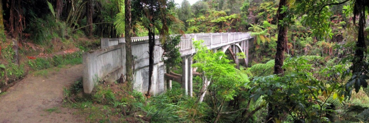
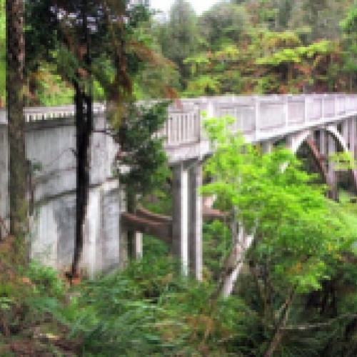
At the lower end of the valley, the track crosses to the true right bank of the stream over the historic "Bridge to Nowhere”. This is a large concrete bridge built in 1936, but is now standing abandoned in the bush in the middle of “Nowhere”.
This last section of the track is formed to walking track standard and is often used by river travelers to visit the Bridge to Nowhere.
Beyond the bridge, it’s another 40mins as the track follows the true right bank of the Mangapurua Stream and then leads along the true left bank of the Whanganui River to reach the Mangapurua Landing.
Note: Mangapurua Landing is a dead-end for walkers
River transport is the only option for those traveling south from Mangapurua Landing. You must pre-book this so jetboats can deliver kayaks or canoes to Mangapurua Landing for you.
Conditions:
- Vehicles on road or track - bikes in particular.
- Poisons & traps
- Small stream crossings
- Track exposed to sun, wind or cold
- Few water sources between National Park and Whakahoro