Can be started at various points.
The award-winning Coastal Walkway is a 12.7km path that forms an expansive sea-edge promenade stretching from Pioneer Park at Port Taranaki all the way to the eastern side of Bell Block Beach.
-
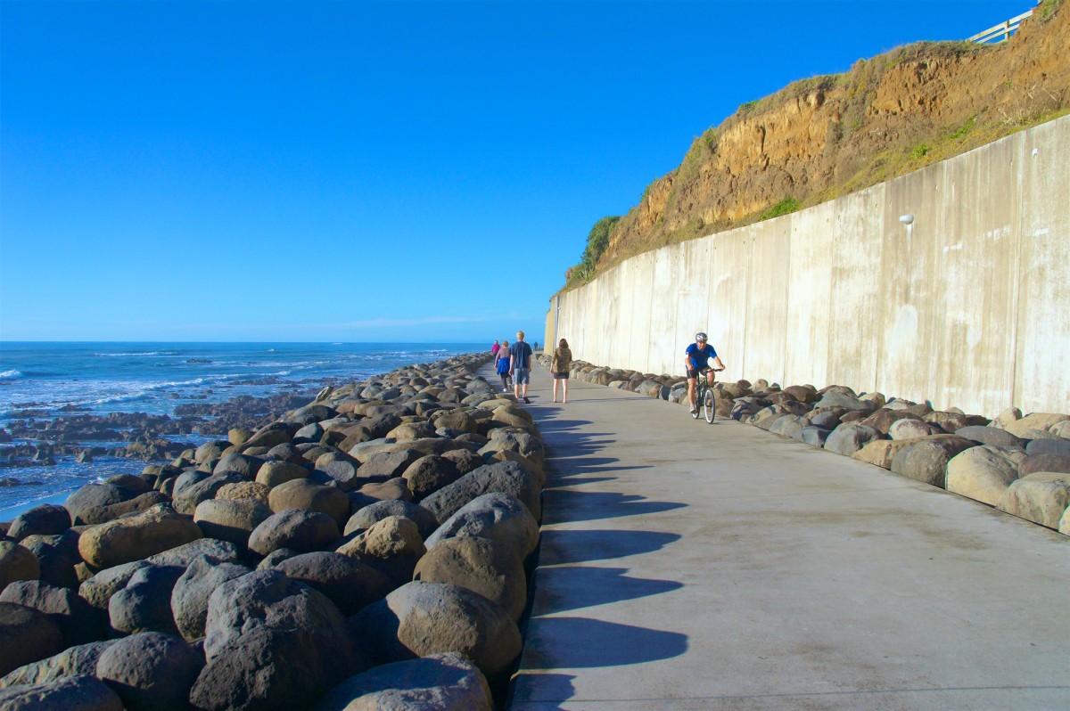 'Coastal Walkway'1 of 2
 -
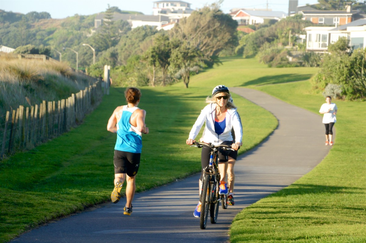 'Coastal Walkway'2 of 2
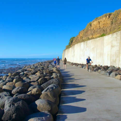
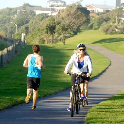
Distance: The Coastal Walkway is 12.7km from Port Taranaki to the eastern end side of Bell Block Beach.
Sections of the Walkway
Port to the Wind Wand: 3.4km
Wind Wand to Te Rewa Rewa Bridge: 4.5km
Te Rewa Rewa Bridge to Tiromoana Cresent, Bell Block: 4.8km
Grade: Easy. The walkway is paved, with some gentle slopes. It is excellent for walking, running, cycling, skateboarding, skating, and scooting. Most people would be able to walk 4 - 6km/hr on the Coastal Walkway.
Location and access
The Coastal Walkway follows the coast from Ngamotu Beach to the eastern side of Bell Block Beach.
There are numerous access points along the Walkway with car parking available in several places. Use the Coastal Walkway map to find entrances to the walkway, available car parking, and other facilities.
Mobility scooters
Electric mobility scooters are available to use free of charge. Their use is restricted to the Coastal Walkway between Port Taranaki and Te Rewa Rewa Bridge.
Bookings are essential and can be made by calling NPDC on 06 759 6060 or emailing enquiries@npdc.govt.nz. The service is run by Taranaki Disabilities Centre Trust. You must show staff that you can drive a scooter and sign a declaration to say you're competent. You will also need personal ID such as a Gold Card.
Using the Walkway
- The Coastal Walkway is a popular place to visit in New Plymouth, please be courteous so it is a great place for everyone to enjoy.
- Road user rules apply, so cyclists must wear helmets.
- Dogs are welcome, but please keep them on a leash.
- When it's busy, keep left.
- Cyclists should ride with care and go slowly through busy areas
Access points and landmarks
- Settlers memorial to The Weymouth Street crossing: 2.7km
- Access to Ngamotu Beach, the marina at Port Taranaki, Todd Energy Aquatic centre and Kawaroa Playground.
- Weymouth Street to the Wind Wand: 0.69km
- Access to the centre of the CBD, Huatoki Walkway (via the CBD) and a playground on the foreshore
- Wind Wand to the marker at the end of the bridge at East End: 1.7km
- Access to the northern end of the CBD
- East End to Fitzroy Beach Holiday Park (by shop): 1.1km
- Access to Te Henui Walkway, East End and Fitzroy beaches, Fitzroy township, Fitzroy pool and playground
- Fitzroy Beach Holiday Park to Waiwakaiho River Mouth: 0.96km
- See the New Plymouth Golf Club
- Waiwakaiho River to Smeaton Road car park: 3.8km
- Access Lake Rotomanu, see the Te Rewa Rewa Bridge, access the Taranaki Velodrome, Hickford Park, and Bell Block Beach.
- Please note: The coastline around Taranaki is continually being eroded by sea and wind action and cliff faces can shed material from time to time so do not picnic, play and spend time at the base of cliff faces.
Coastal Walkway design
- The Coastal Walkway has been designed to suit the greater coastal landscape. The design uses robust and simple materials with strong lines and textures to stand up to, and reflect upon, the character of the west coast.
- The promenade is designed without an edge, to accentuate the sense of being on the edge of the sea, while the curved seawall and location of the path provide protection from the waves. The seawall is also punctured by finger piers, which are designed for people to view and enjoy the open coastline.
- The walkway was designed by Richard Bain Landscape Architects and the isthmus group.
- Te Rewa Rewa Bridge
- The 83m long Te Rewa Rewa bridge is reminiscent of a breaking wave or a whale skeleton. It was designed and built by a consortium led by local company Whitaker Civil Engineering Limited and included Novare Design, CPG, and Fitzroy Engineering.
- The bridge is named after the adjacent pa site and the name itself is very old. The name references the Rewa plant, an elevated flat area, and a point of departure for a journey.
- Te Rewa Rewa reserve is managed by the Te Rewa Rewa management committee, comprising of trustees from the Ngati Tawhirikiura A Hapu and Council officers, as a partnership to meet the aims and aspirations of both the Hapu and Council.
History
- The late 1980s: The Ministry of Defence declares the 26ha Te Rewa Rewa Reserve surplus.
- June 1995: NPDC buys the land with the intention to manage it jointly with Ngati Tawhirikura hapu and use part of it to extend the Coastal Walkway northward.
- 1997: Planning for the Coastal Walkway began.
- October 1999: Construction of the 7km-long Coastal Walkway from Ngamotu Beach in the east to the Waiwhakaiho River in the west began and was completed in December 2001 (excluding the lower Woolcombe Terrace path).
- 2003: The Woolcombe Terrace cliffs were strengthened, and the lower path in front of the cliffs (between the city and East End Reserve) was constructed. The pathway was raised by 2m to a finished height of 7m above sea level.
- 20 December 2003: The walkway was formally opened.
- 11 June 2004: The new ‘lightning bolt’ bridge over Te Henui Stream opened.
- October 2006: Pedestrian bridge and viewing platform from Liardet Street opens.
- 6 June 2007: NPDC and Ngati Tawhirikura Hapu signed Te Rewa Rewa Agreement. NPDC gets a coastal strip to extend the Coastal Walkway to Bell Block, and the hapu can develop the rest of the site for the cultural benefit of the hapu as well as the wider community.
- May 2008: Land Transport New Zealand announces it will pay $1.88m of the cost to extend the Coastal Walkway the 3km from Waiwhakaiho to Bell Block. The rest of the cost is met by NPDC and the Whitaker Family Trust.
- June 2008: At the request of the hapu, the design of the bridge is turned around so that the span opens towards the mountain.
- September 2009: Construction of the abutments on both banks of the Waiwhakaiho River begins.
- 15 February 2010: Te Rewa Rewa Bridge is trucked into place across the Waiwhakaiho River.
- 15 March 2010: Construction of the pathway begins.
- 5 June 2010: Te Rewa Rewa Bridge is formally opened for public use. The public can walk the pathway up to The Links accessway.
- December 2010: The entire 11km (measured from the Settlers’ Monument on Breakwater Road through to the Smeaton Road entrance at Hickford Park, Bell Block) length of the Coastal Walkway extension is opened for public use.
- December 2014: The extension to Bell Block Beach and Tiromoana Crescent opens to bring the walkway length to 12.7km.
Source: New Plymouth District Council

