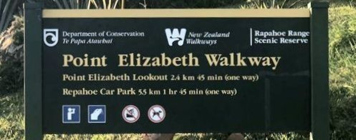
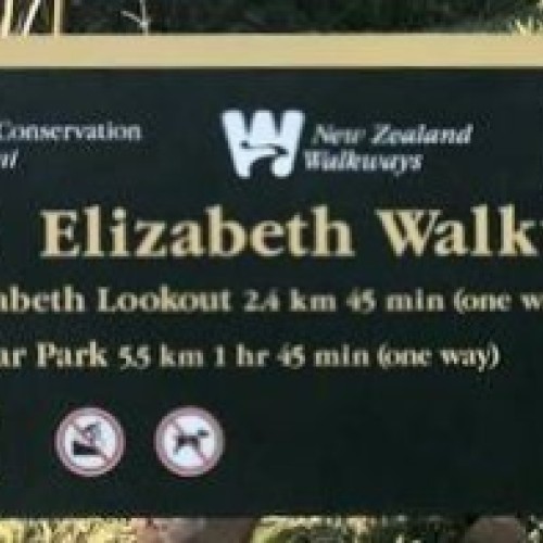
Both Directions. one Way.
A stunning, well surfaced, coastal walkway. Enjoy walking through varied and interesting forest to a panoramic, cliff top viewing platform. Point Elizabeth track is a perfect walk for families and children.
-
 Submitted by Brigit Pratt1 of 10
 -
 Submitted by Brigit Pratt2 of 10
 -
 Submitted by Brigit Pratt3 of 10
 -
 Submitted by Brigit Pratt4 of 10
 -
 Submitted by Brigit Pratt5 of 10
 -
 Submitted by Brigit Pratt6 of 10
 -
 Submitted by Brigit Pratt7 of 10
 -
 Submitted by Brigit Pratt8 of 10
 -
 Submitted by Trevor Crestani9 of 10
 -
 Submitted by Trevor Crestani10 of 10
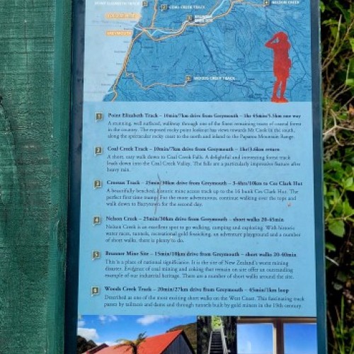
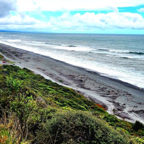
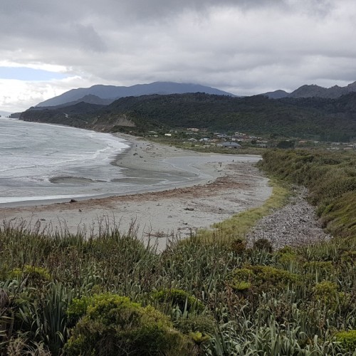
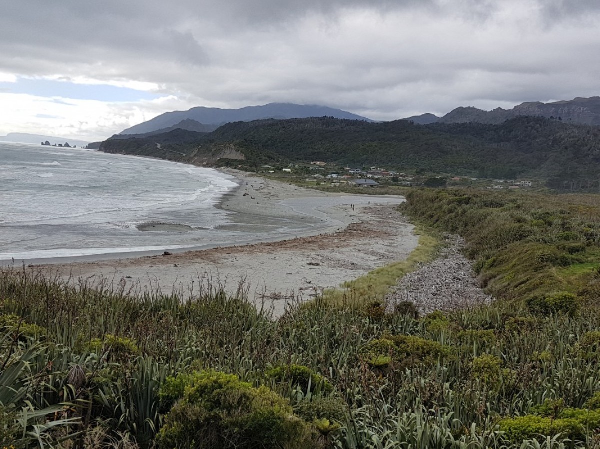
Point Elizabeth Walkway is an interesting coastal/bush walk with good views and a few sites of historic interest along the way.
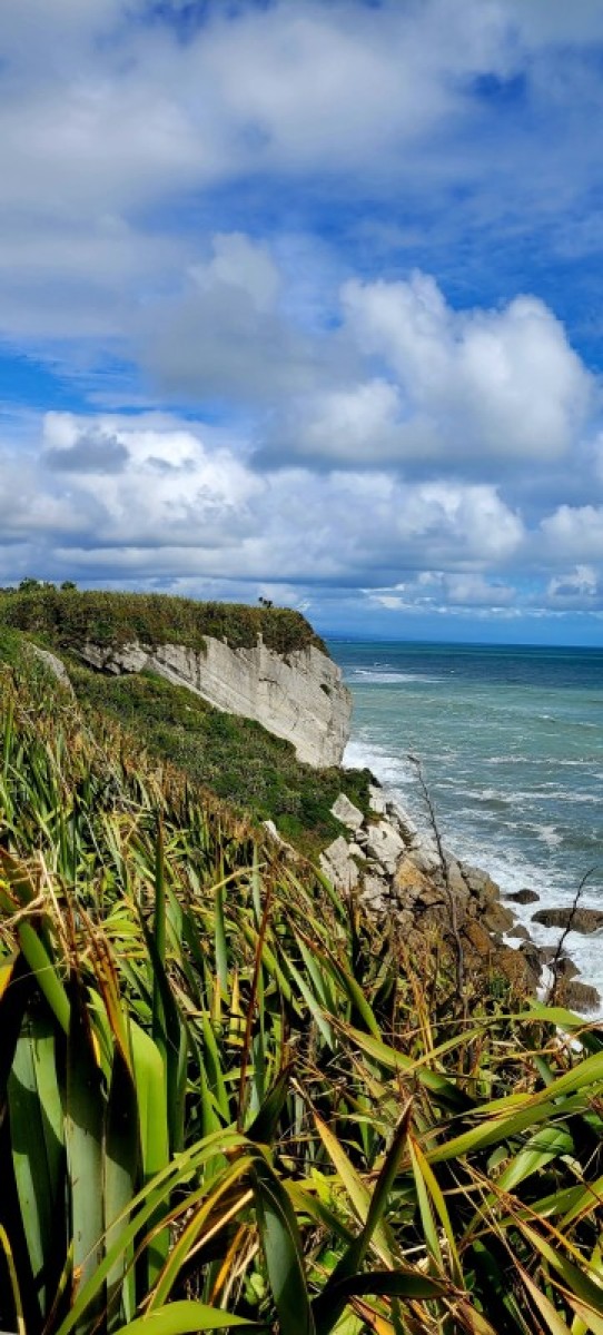
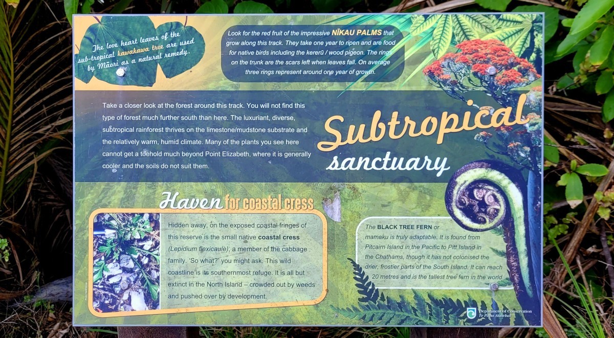
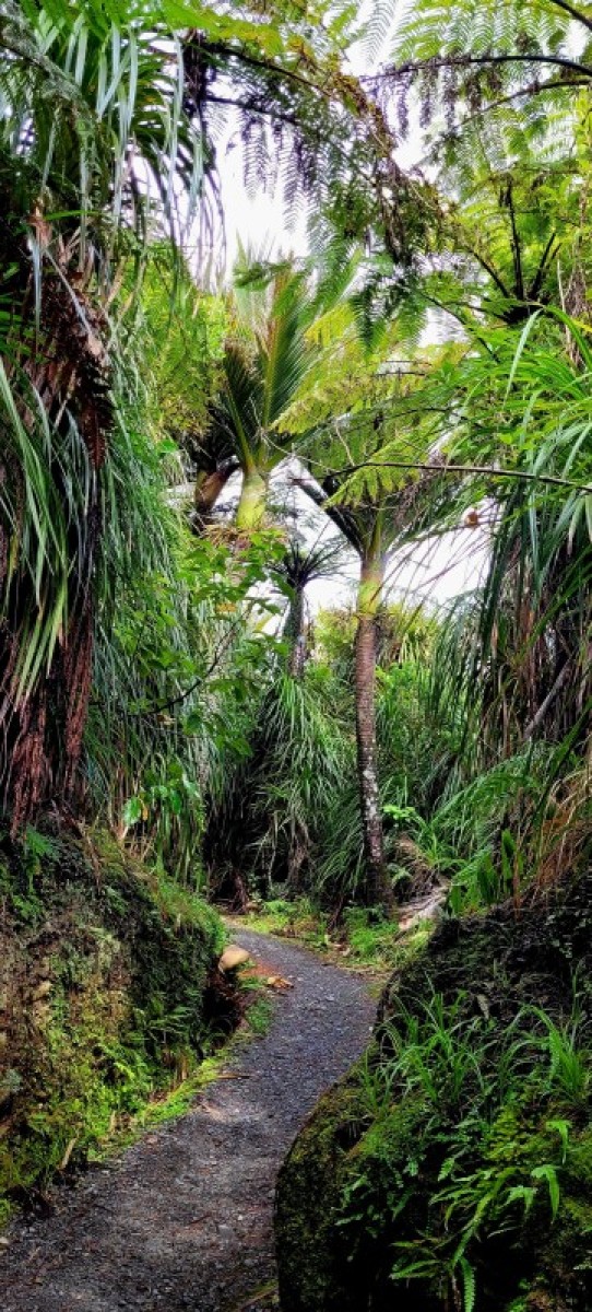
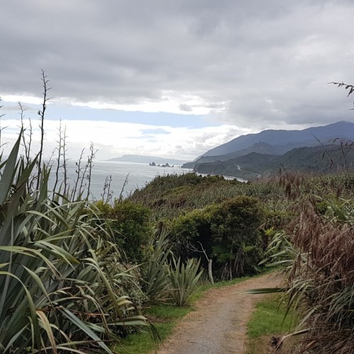
From its northern (Rapahoe) end the track climbs to an open terrace with slowly regenerating in native growth after years of farming. Beyond there, in Rapahoe Scenic Reserve, one of the finest remaining tracts of mixed coastal forest in New Zealand extends from the limestone range out to the cliff edge.
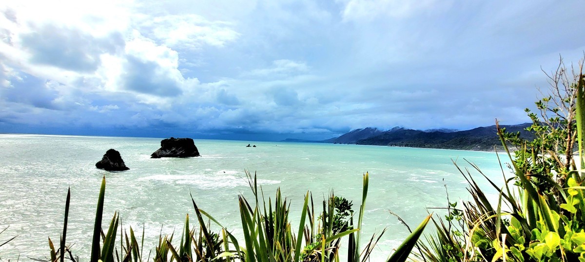
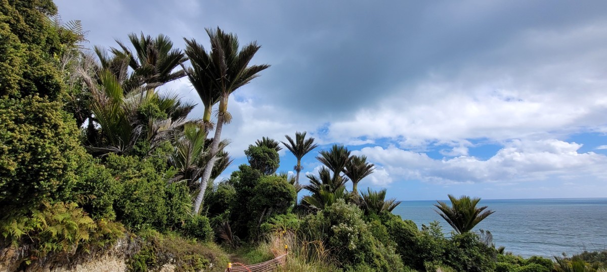
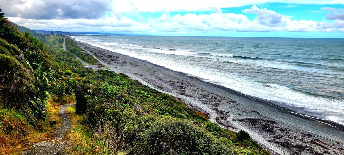
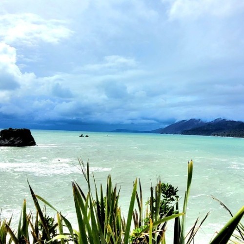
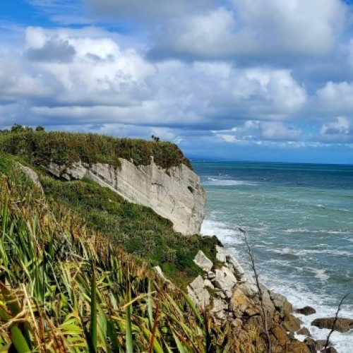
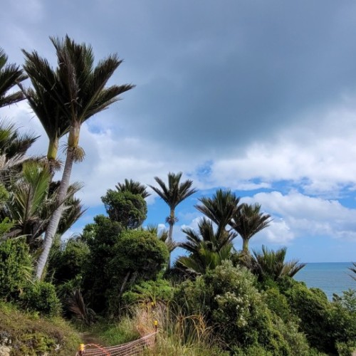
Gradually the sea can be heard again as big forest gives way to more stunted growth and waves of flax on the Point Elizabeth headland. The exposed rocky point lookout has views south toward Mt Cook, north along a spectacular rocky coast and inland towards the Paparoa Mountain Range.
Offshore 'sea stacks' remain as a reminder that the point once extended much farther out to sea. After winding and undulating for a while the track begins to descend toward Cobden's North Beach.
The track is mostly level, as it follows an old water race that miners used to sluice their gold claims.
Mountain biking
Mountain biking is permitted on Point Elizabeth Track from 1 April - 30 September during the hours of darkness only. No mountain biking is permitted during daylight hours. That is 1hr before sunrise and 1hr after sunset. Bikers must use adequate night lights at all times. Caution and care must be taken to prevent injury to any native wildlife encountered on the track. Follow the Mountain Bikers Code.
Getting there
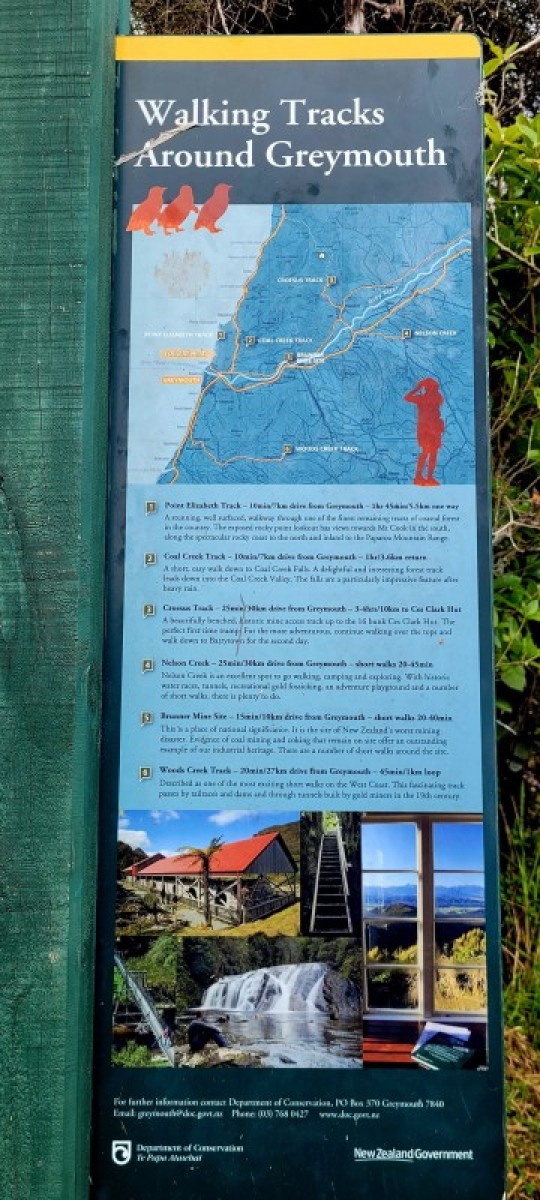
Point Elizabeth can be easily accessed from Greymouth. To reach the northern end drive to Rapahoe on SH6 from Greymouth (about 11km). For the southern end drive via Cobden onto Bright Street, Domett Esplanade and North Beach Road (about 6 km). There are car parks at both ends.
Nature and conservation
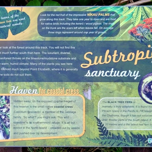
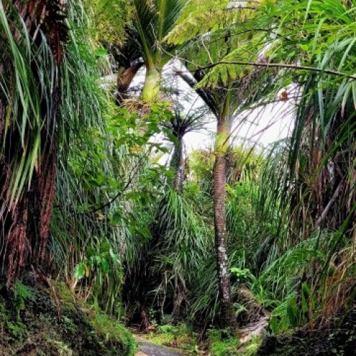
The stunning subtropical forest features nikau palms and mamaku (black tree fern) intertwined with supplejack vines and kiekie. There are also large podocarps like rimu, kahikatea, and miro along with epiphytic northern rata adding a splash of crimson during summer.
Native birds such as fantails, tomtits, grey warblers, and bellbirds are plentiful at any time of year.
History and culture
The track follows an old water race built by 19th-century miners to sluice their gold claims. Much of the track formation also dates from this era, including deep cuttings that would have required considerable effort with pick and shovel.
Source: Department of Conservation

