The Silver Peaks Scenic Reserve provides challenging routes in rugged country, less than 30 minutes drive from Dunedin city.
-
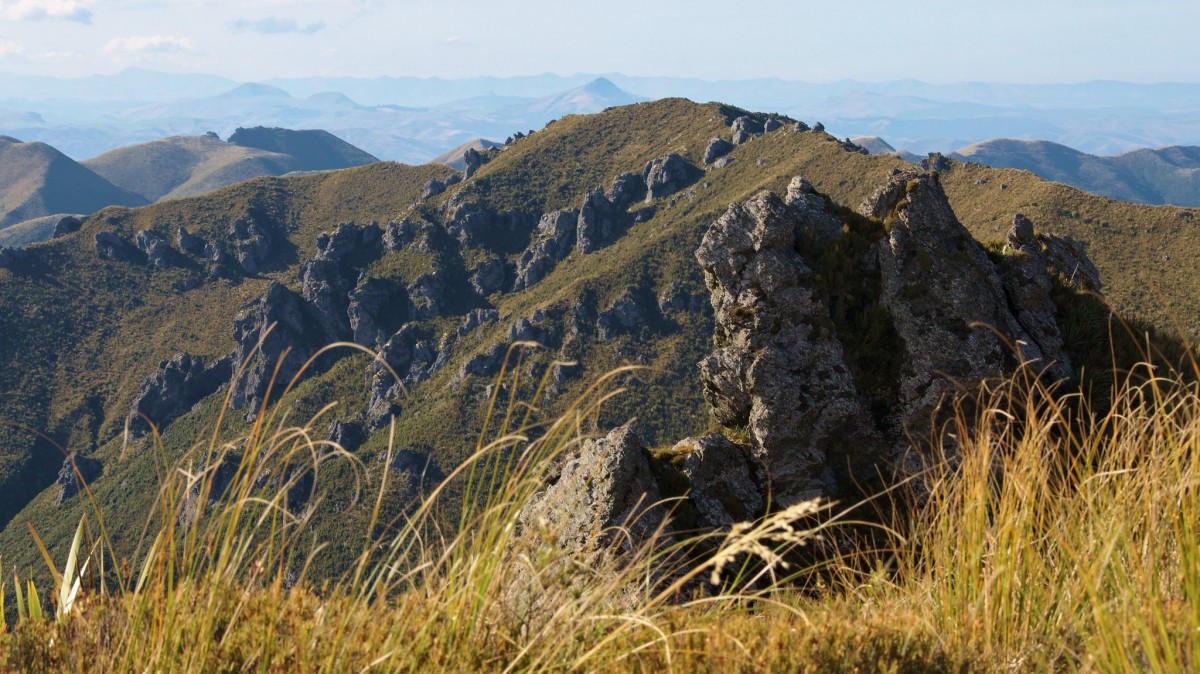 'Cats Teeth Rocks on Rocky Ridge'1 of 3
 -
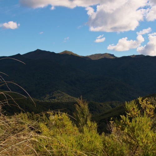
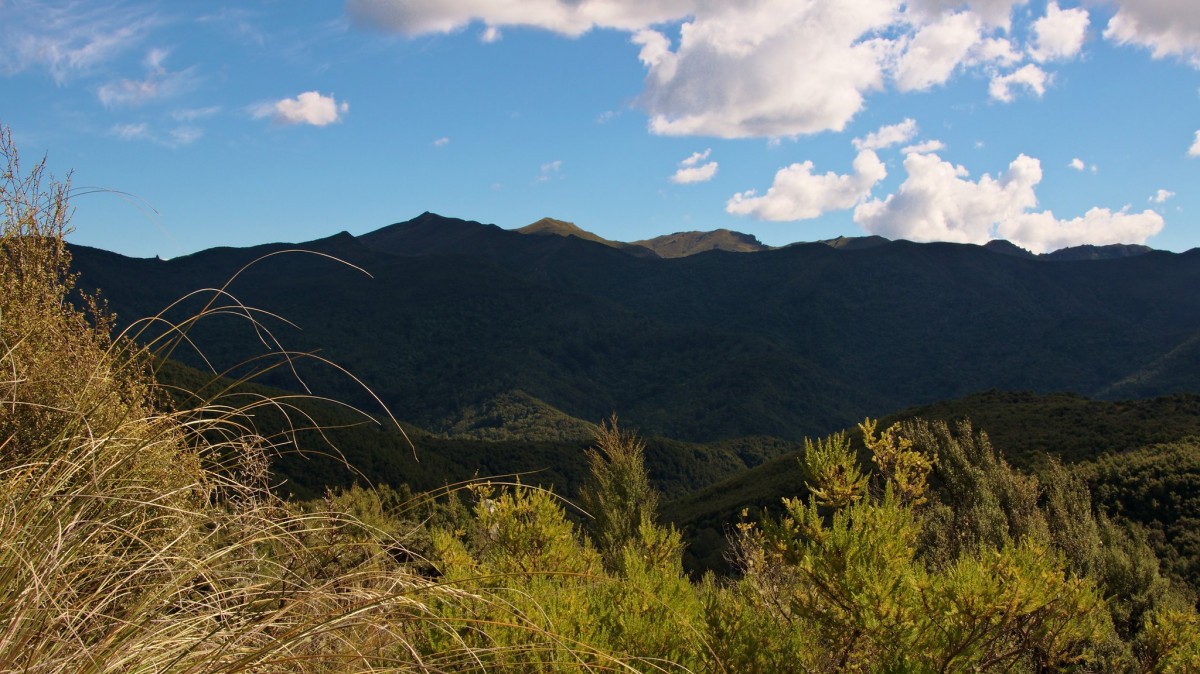 'Skyline of Silver Peaks'2 of 3
 -
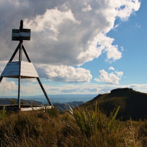
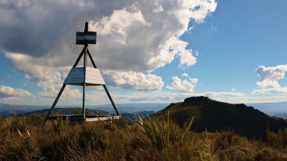 'Trig point on top of Silver Peak'3 of 3
Possum Shelter Route
- Time: 2 - 3 hr
- Distance: 3 km
From Green Hill, the route goes down to the south branch of the Waikouaiti River, passing the historic Possum Shelter, a memorial to the hut builders and old gold diggings from the depression years of the 1930s. The route climbs out to Mountain Road. Return to the car park via Mountain Road.
Swampy Ridge Track
- Hightop to Swampy Summit
- Time: 1 hr 30 min
Signposted from Hightop (on Silver Peaks Track), it takes approximately 1.5 hr to reach Swampy Summit. The track follows part of the historic route that linked the Waikouaiti and Dunedin settlements. The track beyond Swampy Summit continues to join the Leith Saddle Track, and by continuing along the ridge, the Flagstaff-Pineapple Walk (external site) (managed by the Dunedin City Council).
Silver Peaks Track
- Mountain Road car park to Jubilee Hut
- Time: 3 - 4 hr
- Distance: 9 km
Ensure you follow the orange markers. The track begins from Mountain Road car park, and follows Green Ridge to the site of the former Green Hut (now a picnic or camping area without drinking water).
The turnoff to Possum Shelter Route is a little further up Green Hill. The track heads uphill from the Green Hut site and past the turnoff on the right that leads to Possum Hut. The sign beside it, 'Pulpit Rock' and the orange markers confirm the main track to the left. The track traverses a ridge and climbs steadily to Pulpit Rock. The 360º view from the pulpit includes the coast and many major inland ranges.
From Pulpit Rock and along the ridgeline you can view the Painted Forest, a significant stand of silver beech/tahina.
This area is very exposed and weather conditions can change quite suddenly; Māori named this section Paekohu, or 'fog ridge', for good reason. At the sign for 'Jubilee Hut', follow the marked track uphill to the flat rocky crest for a commanding view of the neighbouring valleys and the Rock and Pillar Range.
The track then descends into the schist-tor-encrusted upland valley. After passing a prominent schist tor or obelisk, turn left to look down a steep ridge into the valley. From here Jubilee Hut can be seen in the distance, up on the valley's left flank. Reaching it means negotiating the aptly named Devils Staircase, an unbenched, steep 340 metre descent - take extreme care. At the bottom is a small campsite next to Cave Creek.
The track crosses the creek several times before reaching the sign on the true left, indicating Jubilee Hut is a 5 - 10 minute climb above the intersection.
Jubilee Hut
- Category: Standard
- Facilities: 10 bunk beds, mattresses, toilets - non-flush, water from tap - not treated, boil before use
- Bookings not required - first come, first served
Silver Peaks Route
- Jubilee Hut to ABC Cave
- Time: 2 - 3 hr
- Distance: 3 km
From Jubilee Hut, return to the sign and cross over the creek to the original hut site. This was built by members of the Otago Tramping and Mountaineering Club in 1951 and removed when the new hut was built. The fireplace still remains. At the old hut site, take the track from behind the right hand side of the site, following the orange markers. This climbs the ridge to the north and meets an old farm track by a gate.
Follow the markers along the farm track then turn off at the sign to ABC cave.
ABC Cave to Philip J Cox Memorial Hut
- Time: 2.5 hr
- Distance: 4.8 km
Retrace your steps from ABC Cave to the main route and follow the marked route past The Gap and down Yellow Ridge before reaching Philip J Cox Memorial Hut.
Philip J Cox Memorial Hut
- Category: Standard
- Facilities: 4 bunk beds, mattresses, toilets - non-flush, water from tap - not treated, boil before use
- Bookings not required - first come, first served
Philip J Cox Memorial Hut to Mountain Road
- Time: 1.5 hr
- Distance: 2.2 km
Descend the steep and narrow route, reaching the south branch of the Waikouaiti River. Take great care when crossing the river - it can be dangerous after heavy rain.
Beyond the Waikouaiti River is a grassy clearing with an 'experienced trampers only' sign. From here there's a steep clay track leading to Mountain Road.
Note: The road is closed to vehicles - it is 6 km from the route end back to the car park, taking approximately 1.5 hr.
East of Mountain Road
- Black Gully Dam:
- 30 min
- 1 km (return)
- Careys Creek:
- 3 hr 30 min
- 9 km (one-way)
Black Gully Dam Track is accessed from Semple Road and trampers can go right through to the Careys Creek Reserve at Evansdale. Also from Careys Creek are two routes that reach Mountain Road and can make for a good loop for fit parties.
Getting there
From Dunedin, head north on SH1. Just past the Waitati Store at Blueskin Bay, turn left onto Double Hill Road, and then take the right fork, Semple Road, which runs into Mountain Road. The car park on Mountain Road gives access to the Silver Peaks route, Possum Shelter route and Swampy Ridge track.
Know before you go
- Dogs are permitted from Mountain Road car park to Pulpit Rock only. Dogs must be on a leash.
- A good standard of fitness, equipment and experience is necessary.
- Although the Silver Peaks aren’t high by some standards, this is exposed, rugged, challenging country, with weather conditions that can change rapidly. It is often both fogged in and blasted by south-westerly storms or chilled by the prevailing nor-easterly.
Before you go into the outdoors, tell someone your plans and leave a date to raise the alarm if you haven't returned. To do this, use the New Zealand Outdoors Intentions process (external site) on the AdventureSmart website. It is endorsed by New Zealand's search and rescue agencies and provides three simple options to tell someone you trust the details about your trip.
Source: Department of Conservation

