Follow in the footsteps of Northland's Māori ancestors. This challenging track climbs through coastal forest before revealing a spectacular 360-degree panorama. It's one of our best day hikes.
-
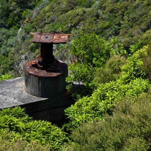
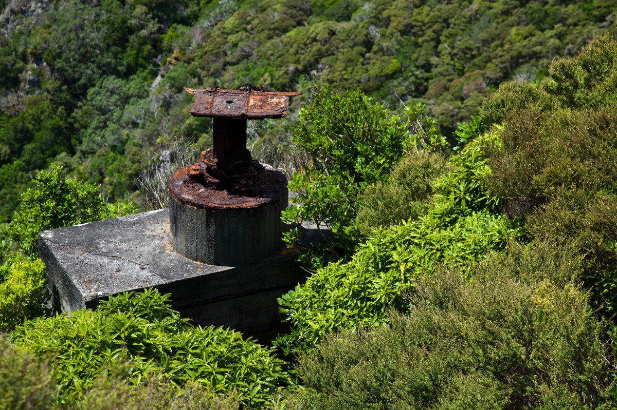 'Remains of the Bream Head Radar Station'1 of 2
 -
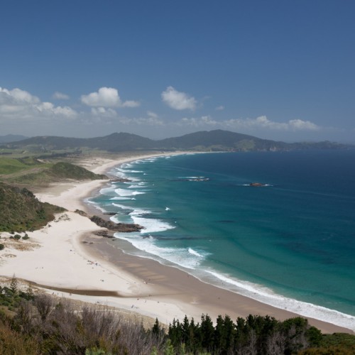
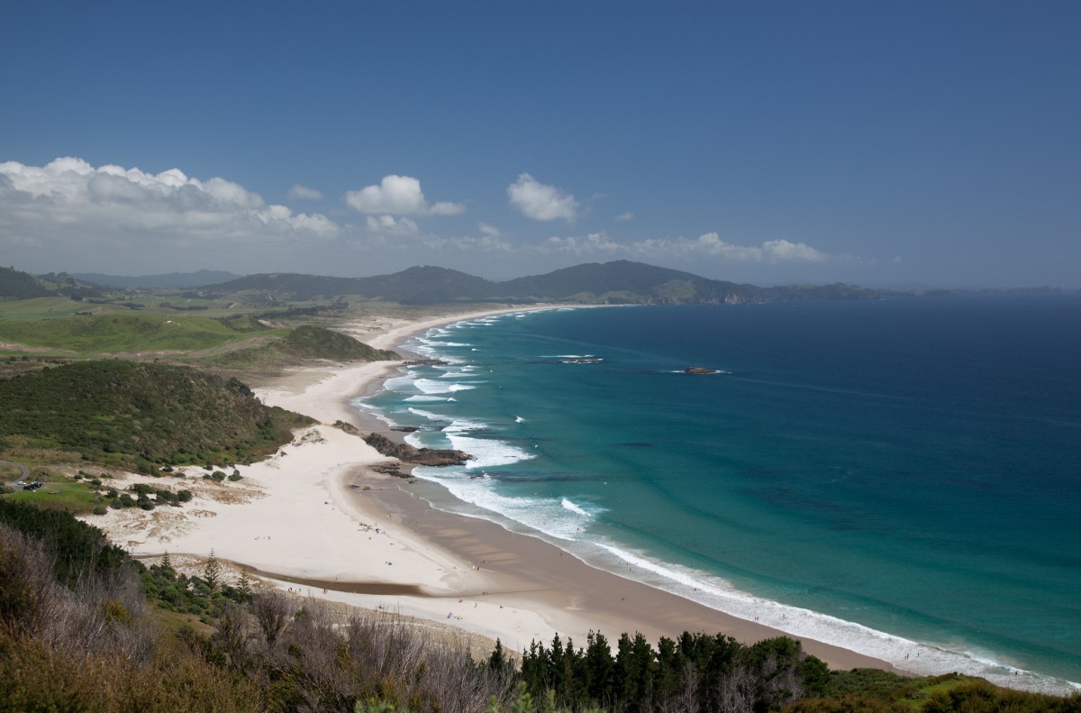 'Ocean Beach'2 of 2
- Some of the best coastal forest in the North Island.
- Magnificent coastal panorama views.
- Ruins of a WWII radar station.
The Te Whara track follows an ancient Māori trail from Ocean Beach to Urquharts Bay.
The track passes through some of the best coastal forests in the North Island. At the Bream Head summit, towards the Ocean Beach end and not far from the ruins of a WWII radar station, enjoy a magnificent coastal panorama. Take in views of Cape Brett (Motukokako) in the north to Cape Rodney (Tawharanui) in the south, as well as the Poor Knights islands Tawhiti Rahi and Aorangi, Taranga and Marotere Islands in the Hen and Chickens Islands group, with Te Hauturu-o-Toi/Little Barrier and Great Barrier/Aotea Island in the far east.
Once you've climbed up onto the ridge, the track becomes undulating and relatively easy-going.
To minimise disturbance to the area, and out of respect to local iwi and their ancestors, do not leave the marked tracks.
Getting there
The nearest town is Whangārei (38 km).
Access this one-way track from the Ocean Beach car park on Ranui Road, finishing at the Urquharts Bay car park. Alternatively, start from the Urquharts Bay car park, finishing at Ocean Beach car park.
If you don't want to walk the entire length of the ridge, you can park at the entrance to Peach Cove Track and enter/exit via that track.
Nature and conservation
There are a number of opportunities to see the recently translocated Whitehead/pōpokotea or the New Zealand robin/toutouwai.
History and culture
Te Whara was the principal wife of the rangatira (chief) Manaia.
It was here that Manaia first met Puhi-moana-āriki, an early ancestor of the Ngāpuhi iwi and cautioned him with the words “Kei whara koe e Puhi i ngā tai e hāruru ana” (You may meet with disaster from the tides that thunder there).
Manaia’s wife is said to have slighted Puhi and was turned into stone. She stands as the projecting up-thrust rock at the eastern-most point of Bream Head, known as ‘Te Wahine iti a Manaia’.
Te Whara Track follows the ancient footprints of Manaia; a track that is at least 700 years old.
Know before you go
What to expect:
- Change in elevation: +/- 456 m
- Hazards:
- Tree roots protrude onto the track
- Rocky outcrops have steep drop-offs - children should be well supervised
- Amenities
- Toilets at the car parks at both track end
- Picnic table at Radar Station near Ocean Beach end
Be prepared
Ensure you take:
- plenty of drinking water
- a water/windproof jacket
- hat and gloves
- sunscreen
- wear warm, layered clothing
- footwear such as light boots
- head torch
- mobile phone
Source: Department of Conservation

