Find Gabriel's Gully in the TD, #8887
Today Gabriel’s Gully is a historical mining reserve (TD #8887), administered by the DOC, and situated just 5kms north of Lawrence, well signposted via a sealed road. Freedom camping is permitted within the Reserve in two areas; the most popular being the first area where you find the information boards. For the more adventurous camper there is a second camping area known as Greys Dam accessed via a shingle road leading from the information area. The distance between the two areas is about 400m. Take care when driving this section of road, as it has a few potholes and limited visibility in places. Large motorhomes and caravans regularly travel this route without any issues.
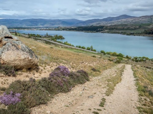
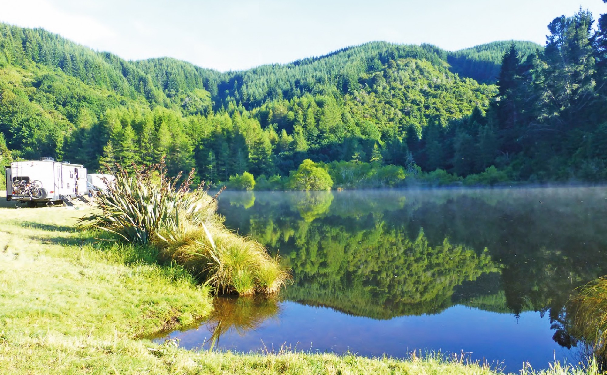
Once you reach the end of the shingle road you will be greeted by one of NZ’s best kept camping secrets, Greys Dam, where there is plenty of room to camp and enjoy the surroundings at the Dam. DOC cut an area of the grass used by campers, and picnic tables are supplied. Levelling blocks are a useful addition when setting up camp. You can camp right down to the waters edge and enjoy the wildlife going about their daily business.
The morning and evening reflections on the dam surface are a photographer’s dream as is the surrounding area. In the few times we have stayed at Greys Dam we have often been on our own, and rarely do you have any more than three or four campers all of which are NZMCA members. Only once have we seen a ‘slider van’ on site. However, the site offers complete peace and tranquillity even with a few visitors present. Greys Dam is fed from the Otago Dam which is sited about 200m higher in the surrounding hills, a walking track runs between the two points. The area around the dams has in the past been cleared and exotic forestry planted but the native forest has been retained in the immediate valley area between the two dams.
The walk between the dams took us 1hr 20mins, the return trip 1hr 5mins; talking to others these times are pretty typical. To tackle this walk you will need to be of medium fitness and good sturdy footwear is a must as there are muddy sections and steep sections to contend with. A walking stick is a useful addition but don’t worry if you don’t have one, we found ours enroute.
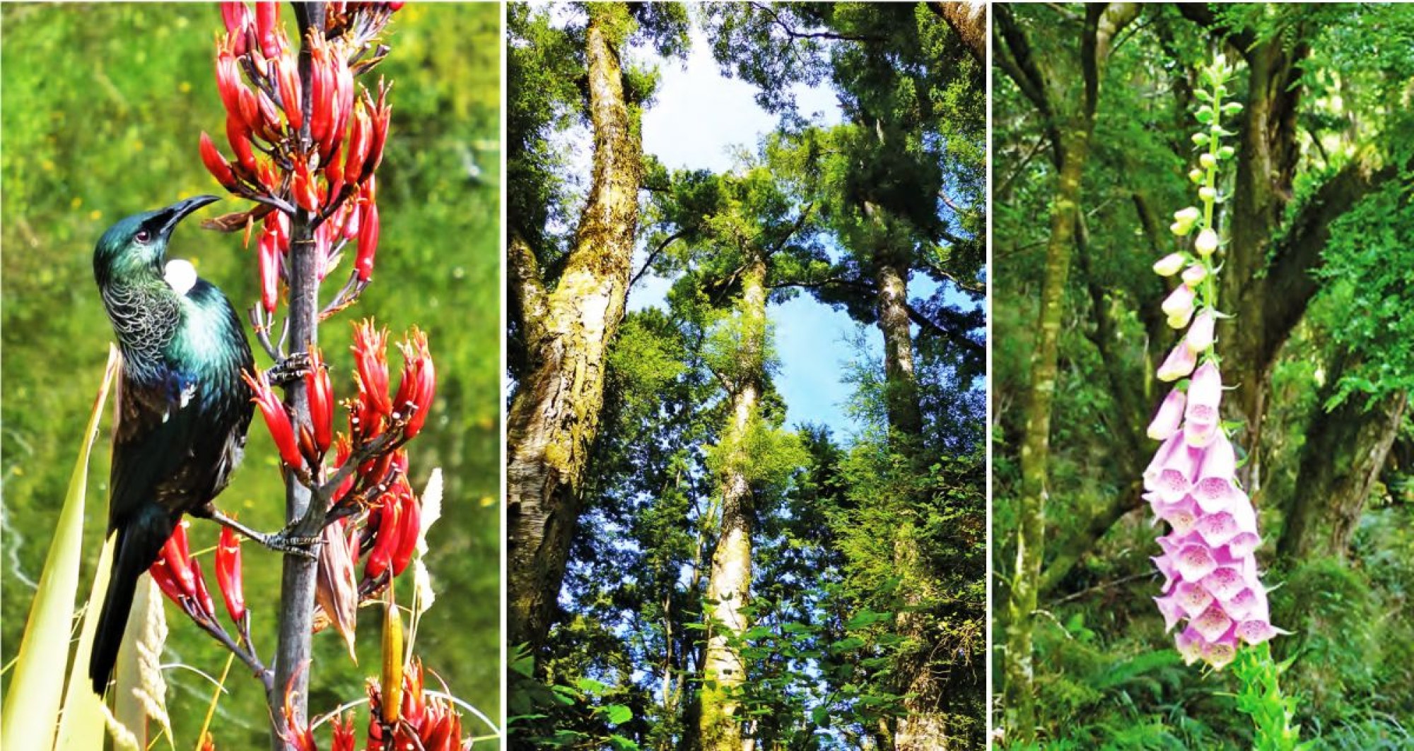
The walking track starts at the western end of Greys Dam at a well-marked sign. Initially the track follows the edge of the dam, travelling through a section of exotic forest before entering the native bush. After about 15mins of easy walking, the track climbs steeply, it then flattens out and you will encounter old water races built by miners in their quest for gold. Water was necessary to extract the gold and there are many kilometres of races and pipelines present within the greater reserve, water was almost as precious to the miner as gold itself. Continuing the walk one encounters a few flat areas where fuchsias, cow parsley, daisies and hollyhocks grow - a reminder that once miners’ shacks were dotted along the creek and track in this area.
Meeting nature first-hand
Travelling on you will need to cross the creek in a few places; we managed this without wet feet. The valley floor has many magnificent native trees, ferns, lancewoods, whitewoods, five fingers and numerous other natives not known to me by name. We walked the track mid-January and the foxgloves dotted along the track were in full bloom. The track has some fairly steep sections but nothing dangerous in good weather. As you walk the track take particular note of the DOC signs warning about the potential for flash floods in sections of the track most likely during winter or wet weather.
The warnings are real as is evident by the slips and log jams you will see while walking, obviously these occur during periods of heavy rainfall most likely during the winter months.
After about an hour of walking you will leave the native bush and climb through exotic forest emerging at the Otago Dam. It was the height of summer when we visited and this dam was only partially full but nevertheless we enjoyed the walk and saw great reflections in this historical mining reserve. We returned via the same route.
Safety Note: It is not advisable to walk this track during wet weather or during heavy rainfall.
The nearby town of Lawrence is also a special place where there is great service from friendly locals and we never pass up the opportunity to visit ‘Jan the butcher’ (a very famous lady) and the local chocolate shop where the handmade treats are to die for. Lawrence also has a genuine general store jam-packed with all sorts of treasures.
Around the area you will find plenty to explore, including other old gold ghost towns, a Chinese settlement, and the Tuapeka Ferry which crosses the Clutha River. The Tuapeka ferry is free to travel with your caravan or motorhome, or just as a foot passenger.
Check the ferry schedule times at the excellent Lawrence information centre. For cyclists the Clutha Gold trail ends here. Open all year, this 73 kilometre easy grade trail passes through four settlements along the way – Roxburgh, Millers Flat, Beaumont and Lawrence – and can take between two and four days to complete. This trail can be cycled in either direction.
It’s certainly not hard to spend a few days at Greys Dam/Lawrence exercising and feasting on the local treats. Lawrence has a good supermarket to allow you to restock, fuel and bottled LPG is available within the town. There is also an excellent dump station and potable water supply about 1km west of Lawrence, opposite the Police Station. We always find the locals are very welcoming, making this area one of our favourite camping spots in NZ.
Words and photos by John Elvy, #41261


Related content